
M38A Pleasantville, IA, USA - Earthquake Result Viewer

| ||||||||||||||||||
| ||||||||||||||||||
| ||||||||||||||||||
|
Signal To Noise
| Channel | StoN | STA | LTA |
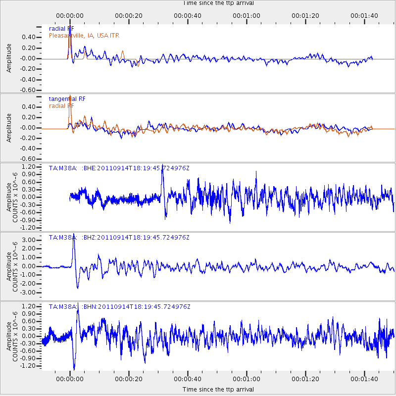
| TA:M38A: :BHZ:20110914T18:19:45.724976Z | 13.528837 | 1.4202276E-6 | 1.0497781E-7 |
| TA:M38A: :BHN:20110914T18:19:45.724976Z | 3.7442737 | 6.006672E-7 | 1.6042289E-7 |
| TA:M38A: :BHE:20110914T18:19:45.724976Z | 2.7300837 | 4.3990494E-7 | 1.611324E-7 |
| Arrivals | |
| Ps | 5.3 SECOND |
| PpPs | 16 SECOND |
| PsPs/PpSs | 21 SECOND |

