P37A Lathrop, MO, USA - Earthquake Result Viewer
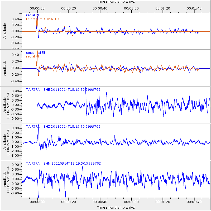
Earthquake location: Near Islands, Aleutian Islands
Earthquake latitude/longitude: 53.1/173.0
Earthquake time(UTC): 2011/09/14 (257) 18:10:09 GMT
Earthquake Depth: 15 km
Earthquake Magnitude: 6.1 MB, 5.7 MS, 6.0 MW, 6.0 MW
Earthquake Catalog/Contributor: WHDF/NEIC
Network: TA USArray Transportable Network (new EarthScope stations)
Station: P37A Lathrop, MO, USA
Lat/Lon: 39.59 N/94.35 W
Elevation: 300 m
Distance: 61.0 deg
Az: 61.946 deg
Baz: 316.485 deg
Ray Param: 0.061145358
Estimated Moho Depth: 38.0 km
Estimated Crust Vp/Vs: 2.09
Assumed Crust Vp: 6.498 km/s
Estimated Crust Vs: 3.109 km/s
Estimated Crust Poisson's Ratio: 0.35
Radial Match: 80.626526 %
Radial Bump: 400
Transverse Match: 70.68099 %
Transverse Bump: 400
SOD ConfigId: 414626
Insert Time: 2012-01-23 10:50:55.873 +0000
GWidth: 2.5
Max Bumps: 400
Tol: 0.001

Signal To Noise

ChannelStoNSTALTA
TA:P37A: :BHZ:20110914T18:19:50.599976Z7.3141721.2975128E-61.773971E-7
TA:P37A: :BHN:20110914T18:19:50.599976Z3.07254484.4040462E-71.4333547E-7
TA:P37A: :BHE:20110914T18:19:50.599976Z3.70029334.0560116E-71.0961325E-7
Arrivals
Ps6.6 SECOND
PpPs17 SECOND
PsPs/PpSs24 SECOND