
P38A Dawn, MO, USA - Earthquake Result Viewer
| ||||||||||||||||||
| ||||||||||||||||||
| ||||||||||||||||||
|
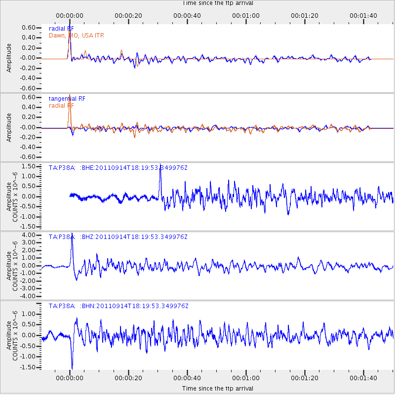
Signal To Noise
| Channel | StoN | STA | LTA |
| TA:P38A: :BHZ:20110914T18:19:53.349976Z | 9.640006 | 1.3859923E-6 | 1.4377504E-7 |
| TA:P38A: :BHN:20110914T18:19:53.349976Z | 6.3847847 | 5.245767E-7 | 8.216044E-8 |
| TA:P38A: :BHE:20110914T18:19:53.349976Z | 4.841729 | 4.8731135E-7 | 1.006482E-7 |
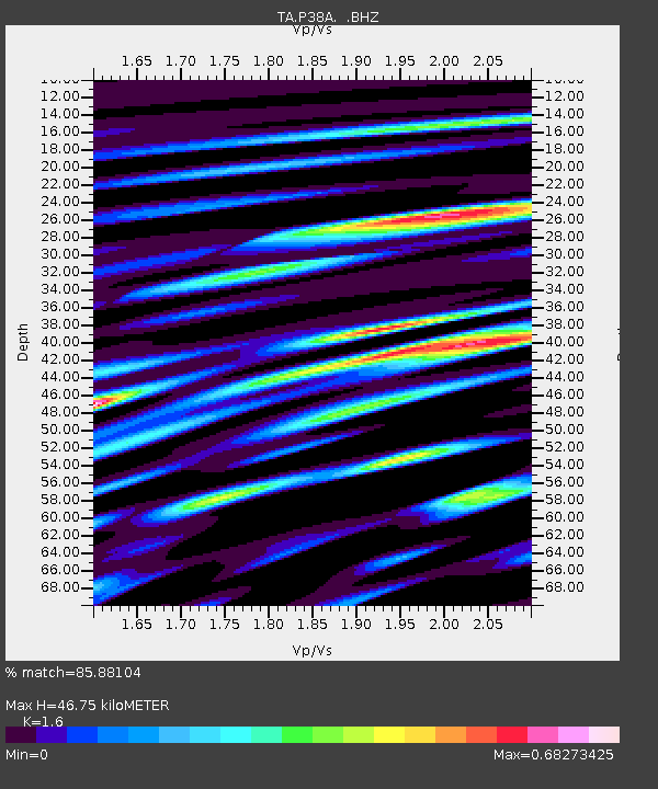
| Arrivals | |
| Ps | 4.5 SECOND |
| PpPs | 18 SECOND |
| PsPs/PpSs | 22 SECOND |

