W39A Magazine, AR, USA - Earthquake Result Viewer
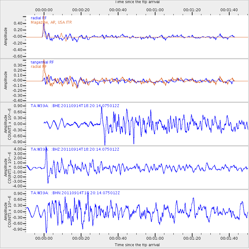
Earthquake location: Near Islands, Aleutian Islands
Earthquake latitude/longitude: 53.1/173.0
Earthquake time(UTC): 2011/09/14 (257) 18:10:09 GMT
Earthquake Depth: 15 km
Earthquake Magnitude: 6.1 MB, 5.7 MS, 6.0 MW, 6.0 MW
Earthquake Catalog/Contributor: WHDF/NEIC
Network: TA USArray Transportable Network (new EarthScope stations)
Station: W39A Magazine, AR, USA
Lat/Lon: 35.20 N/93.78 W
Elevation: 162 m
Distance: 64.5 deg
Az: 64.915 deg
Baz: 318.187 deg
Ray Param: 0.05884855
Estimated Moho Depth: 17.0 km
Estimated Crust Vp/Vs: 1.97
Assumed Crust Vp: 6.498 km/s
Estimated Crust Vs: 3.302 km/s
Estimated Crust Poisson's Ratio: 0.33
Radial Match: 81.59991 %
Radial Bump: 400
Transverse Match: 68.091835 %
Transverse Bump: 400
SOD ConfigId: 414626
Insert Time: 2012-01-23 10:53:31.780 +0000
GWidth: 2.5
Max Bumps: 400
Tol: 0.001

Signal To Noise

ChannelStoNSTALTA
TA:W39A: :BHZ:20110914T18:20:14.075012Z10.2939191.7963637E-61.7450728E-7
TA:W39A: :BHN:20110914T18:20:14.075012Z3.7193444.2505346E-71.1428184E-7
TA:W39A: :BHE:20110914T18:20:14.075012Z3.93206334.212129E-71.0712261E-7
Arrivals
Ps2.6 SECOND
PpPs7.5 SECOND
PsPs/PpSs10 SECOND