Y46A Houston, MS, USA - Earthquake Result Viewer
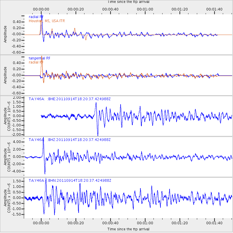
Earthquake location: Near Islands, Aleutian Islands
Earthquake latitude/longitude: 53.1/173.0
Earthquake time(UTC): 2011/09/14 (257) 18:10:09 GMT
Earthquake Depth: 15 km
Earthquake Magnitude: 6.1 MB, 5.7 MS, 6.0 MW, 6.0 MW
Earthquake Catalog/Contributor: WHDF/NEIC
Network: TA USArray Transportable Network (new EarthScope stations)
Station: Y46A Houston, MS, USA
Lat/Lon: 33.88 N/88.86 W
Elevation: 109 m
Distance: 68.2 deg
Az: 62.496 deg
Baz: 319.998 deg
Ray Param: 0.056456473
Estimated Moho Depth: 54.5 km
Estimated Crust Vp/Vs: 1.69
Assumed Crust Vp: 6.201 km/s
Estimated Crust Vs: 3.664 km/s
Estimated Crust Poisson's Ratio: 0.23
Radial Match: 87.25643 %
Radial Bump: 375
Transverse Match: 78.637054 %
Transverse Bump: 400
SOD ConfigId: 414626
Insert Time: 2012-01-23 10:57:14.692 +0000
GWidth: 2.5
Max Bumps: 400
Tol: 0.001

Signal To Noise

ChannelStoNSTALTA
TA:Y46A: :BHZ:20110914T18:20:37.424988Z17.518621.8305857E-61.04493715E-7
TA:Y46A: :BHN:20110914T18:20:37.424988Z5.2741657.1053154E-71.3471924E-7
TA:Y46A: :BHE:20110914T18:20:37.424988Z6.6669928.149269E-71.2223308E-7
Arrivals
Ps6.3 SECOND
PpPs23 SECOND
PsPs/PpSs29 SECOND