You are here: Home > Network List > TA - USArray Transportable Network (new EarthScope stations) Stations List
> Station TPFO Pinon Flats, CA, USA > Earthquake Result Viewer
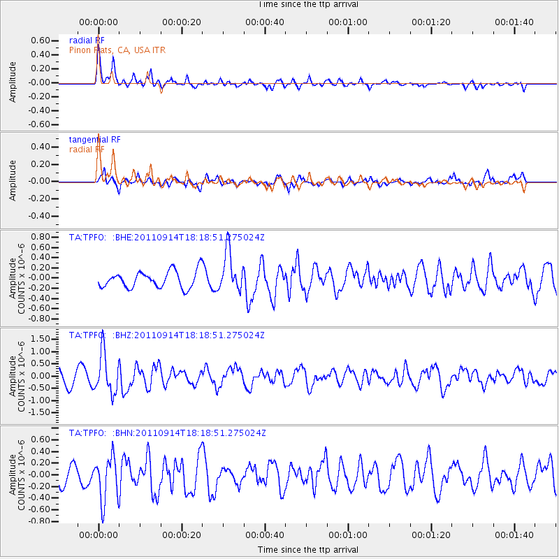
TPFO Pinon Flats, CA, USA - Earthquake Result Viewer
*The percent match for this event was below the threshold and hence no stack was calculated.
| Earthquake location: |
Near Islands, Aleutian Islands |
| Earthquake latitude/longitude: |
53.1/173.0 |
| Earthquake time(UTC): |
2011/09/14 (257) 18:10:09 GMT |
| Earthquake Depth: |
15 km |
| Earthquake Magnitude: |
6.1 MB, 5.7 MS, 6.0 MW, 6.0 MW |
| Earthquake Catalog/Contributor: |
WHDF/NEIC |
|
| Network: |
TA USArray Transportable Network (new EarthScope stations) |
| Station: |
TPFO Pinon Flats, CA, USA |
| Lat/Lon: |
33.61 N/116.45 W |
| Elevation: |
1275 m |
|
| Distance: |
52.6 deg |
| Az: |
82.004 deg |
| Baz: |
314.325 deg |
| Ray Param: |
$rayparam |
*The percent match for this event was below the threshold and hence was not used in the summary stack. |
|
| Radial Match: |
71.10852 % |
| Radial Bump: |
381 |
| Transverse Match: |
67.50331 % |
| Transverse Bump: |
400 |
| SOD ConfigId: |
414626 |
| Insert Time: |
2012-01-23 10:57:58.438 +0000 |
| GWidth: |
2.5 |
| Max Bumps: |
400 |
| Tol: |
0.001 |
|
Signal To Noise
| Channel | StoN | STA | LTA |
| TA:TPFO: :BHZ:20110914T18:18:51.275024Z | 3.4026344 | 8.354531E-7 | 2.4553125E-7 |
| TA:TPFO: :BHN:20110914T18:18:51.275024Z | 3.023121 | 3.887928E-7 | 1.2860643E-7 |
| TA:TPFO: :BHE:20110914T18:18:51.275024Z | 2.4581118 | 4.0134873E-7 | 1.6327523E-7 |
| Arrivals |
| Ps | |
| PpPs | |
| PsPs/PpSs | |


