Y41A Eaglette Bearden, AR, USA - Earthquake Result Viewer
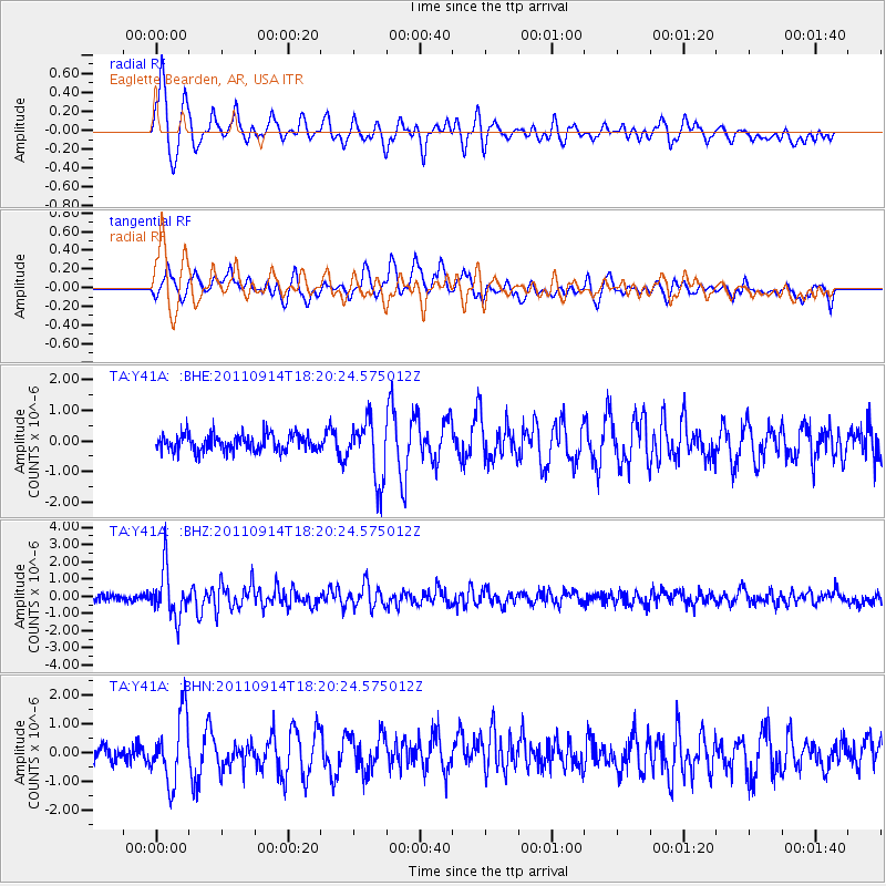
Earthquake location: Near Islands, Aleutian Islands
Earthquake latitude/longitude: 53.1/173.0
Earthquake time(UTC): 2011/09/14 (257) 18:10:09 GMT
Earthquake Depth: 15 km
Earthquake Magnitude: 6.1 MB, 5.7 MS, 6.0 MW, 6.0 MW
Earthquake Catalog/Contributor: WHDF/NEIC
Network: TA USArray Transportable Network (new EarthScope stations)
Station: Y41A Eaglette Bearden, AR, USA
Lat/Lon: 33.88 N/92.61 W
Elevation: 99 m
Distance: 66.2 deg
Az: 65.072 deg
Baz: 318.914 deg
Ray Param: 0.057787396
Estimated Moho Depth: 12.5 km
Estimated Crust Vp/Vs: 1.60
Assumed Crust Vp: 6.245 km/s
Estimated Crust Vs: 3.903 km/s
Estimated Crust Poisson's Ratio: 0.18
Radial Match: 83.720924 %
Radial Bump: 400
Transverse Match: 78.12491 %
Transverse Bump: 400
SOD ConfigId: 414626
Insert Time: 2012-01-23 10:58:08.986 +0000
GWidth: 2.5
Max Bumps: 400
Tol: 0.001

Signal To Noise

ChannelStoNSTALTA
TA:Y41A: :BHZ:20110914T18:20:24.575012Z8.7462671.3909001E-61.5902785E-7
TA:Y41A: :BHN:20110914T18:20:24.575012Z4.22584251.1638999E-62.7542436E-7
TA:Y41A: :BHE:20110914T18:20:24.575012Z3.60600889.815792E-72.7220656E-7
Arrivals
Ps1.3 SECOND
PpPs5.0 SECOND
PsPs/PpSs6.2 SECOND