
S44A Carbondale, IL, USA - Earthquake Result Viewer
| ||||||||||||||||||
| ||||||||||||||||||
| ||||||||||||||||||
|
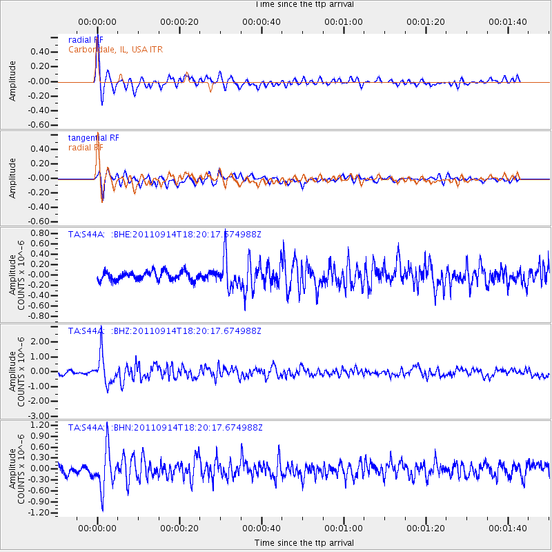
Signal To Noise
| Channel | StoN | STA | LTA |
| TA:S44A: :BHZ:20110914T18:20:17.674988Z | 7.442488 | 1.0001268E-6 | 1.343807E-7 |
| TA:S44A: :BHN:20110914T18:20:17.674988Z | 4.5224996 | 5.500339E-7 | 1.2162167E-7 |
| TA:S44A: :BHE:20110914T18:20:17.674988Z | 3.4699159 | 2.8964504E-7 | 8.347322E-8 |
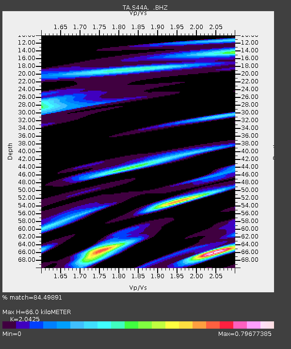
| Arrivals | |
| Ps | 11 SECOND |
| PpPs | 30 SECOND |
| PsPs/PpSs | 41 SECOND |

