
P42A Winchester, IL, USA - Earthquake Result Viewer
| ||||||||||||||||||
| ||||||||||||||||||
| ||||||||||||||||||
|
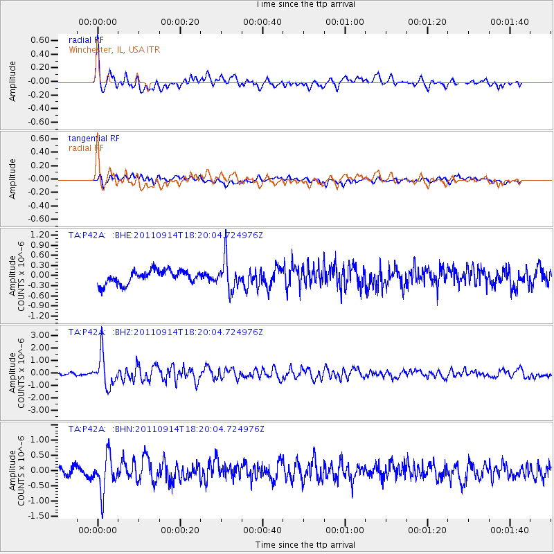
Signal To Noise
| Channel | StoN | STA | LTA |
| TA:P42A: :BHZ:20110914T18:20:04.724976Z | 15.12209 | 1.3076594E-6 | 8.6473456E-8 |
| TA:P42A: :BHN:20110914T18:20:04.724976Z | 4.963723 | 6.123838E-7 | 1.2337188E-7 |
| TA:P42A: :BHE:20110914T18:20:04.724976Z | 2.3551118 | 4.6691764E-7 | 1.982571E-7 |
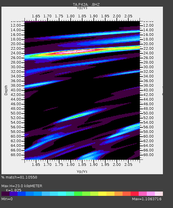
| Arrivals | |
| Ps | 3.1 SECOND |
| PpPs | 9.6 SECOND |
| PsPs/PpSs | 13 SECOND |

