S42A Caledonia, MO, USA - Earthquake Result Viewer
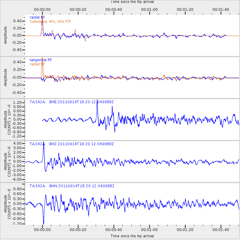
Earthquake location: Near Islands, Aleutian Islands
Earthquake latitude/longitude: 53.1/173.0
Earthquake time(UTC): 2011/09/14 (257) 18:10:09 GMT
Earthquake Depth: 15 km
Earthquake Magnitude: 6.1 MB, 5.7 MS, 6.0 MW, 6.0 MW
Earthquake Catalog/Contributor: WHDF/NEIC
Network: TA USArray Transportable Network (new EarthScope stations)
Station: S42A Caledonia, MO, USA
Lat/Lon: 37.77 N/90.79 W
Elevation: 315 m
Distance: 64.2 deg
Az: 61.024 deg
Baz: 318.275 deg
Ray Param: 0.05904746
Estimated Moho Depth: 14.25 km
Estimated Crust Vp/Vs: 1.70
Assumed Crust Vp: 6.53 km/s
Estimated Crust Vs: 3.841 km/s
Estimated Crust Poisson's Ratio: 0.24
Radial Match: 87.35286 %
Radial Bump: 304
Transverse Match: 75.97843 %
Transverse Bump: 400
SOD ConfigId: 414626
Insert Time: 2012-01-23 11:00:57.992 +0000
GWidth: 2.5
Max Bumps: 400
Tol: 0.001

Signal To Noise

ChannelStoNSTALTA
TA:S42A: :BHZ:20110914T18:20:12.049988Z9.6938561.4630936E-61.5092998E-7
TA:S42A: :BHN:20110914T18:20:12.049988Z5.10653643.851549E-77.5423905E-8
TA:S42A: :BHE:20110914T18:20:12.049988Z5.6414164.146877E-77.350773E-8
Arrivals
Ps1.6 SECOND
PpPs5.6 SECOND
PsPs/PpSs7.2 SECOND