R42A Luebbering, MO, USA - Earthquake Result Viewer
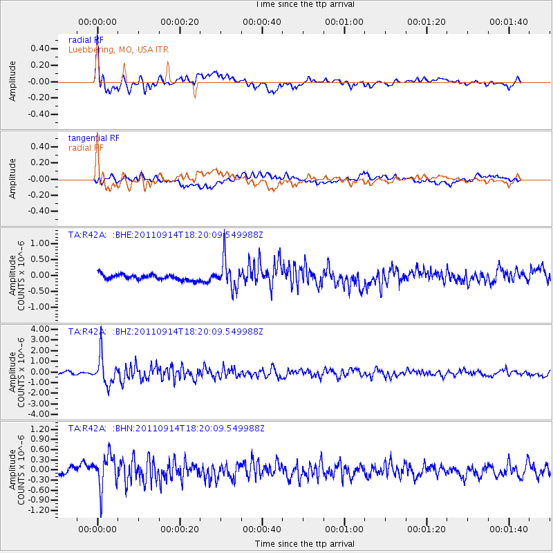
Earthquake location: Near Islands, Aleutian Islands
Earthquake latitude/longitude: 53.1/173.0
Earthquake time(UTC): 2011/09/14 (257) 18:10:09 GMT
Earthquake Depth: 15 km
Earthquake Magnitude: 6.1 MB, 5.7 MS, 6.0 MW, 6.0 MW
Earthquake Catalog/Contributor: WHDF/NEIC
Network: TA USArray Transportable Network (new EarthScope stations)
Station: R42A Luebbering, MO, USA
Lat/Lon: 38.28 N/90.79 W
Elevation: 218 m
Distance: 63.8 deg
Az: 60.647 deg
Baz: 318.109 deg
Ray Param: 0.059299555
Estimated Moho Depth: 62.0 km
Estimated Crust Vp/Vs: 2.06
Assumed Crust Vp: 6.498 km/s
Estimated Crust Vs: 3.158 km/s
Estimated Crust Poisson's Ratio: 0.35
Radial Match: 85.041084 %
Radial Bump: 400
Transverse Match: 64.62584 %
Transverse Bump: 400
SOD ConfigId: 414626
Insert Time: 2012-01-23 11:01:12.332 +0000
GWidth: 2.5
Max Bumps: 400
Tol: 0.001

Signal To Noise

ChannelStoNSTALTA
TA:R42A: :BHZ:20110914T18:20:09.549988Z9.6707681.3644124E-61.4108625E-7
TA:R42A: :BHN:20110914T18:20:09.549988Z5.59860234.972793E-78.882204E-8
TA:R42A: :BHE:20110914T18:20:09.549988Z5.35899934.5724767E-78.532333E-8
Arrivals
Ps10 SECOND
PpPs28 SECOND
PsPs/PpSs39 SECOND