
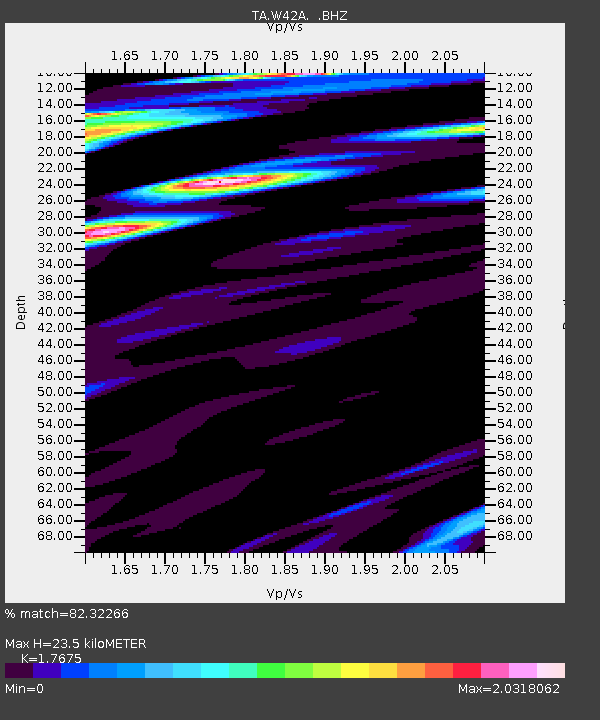
W42A Bald Knob, AR, USA - Earthquake Result Viewer
| ||||||||||||||||||
| ||||||||||||||||||
| ||||||||||||||||||
|
Signal To Noise
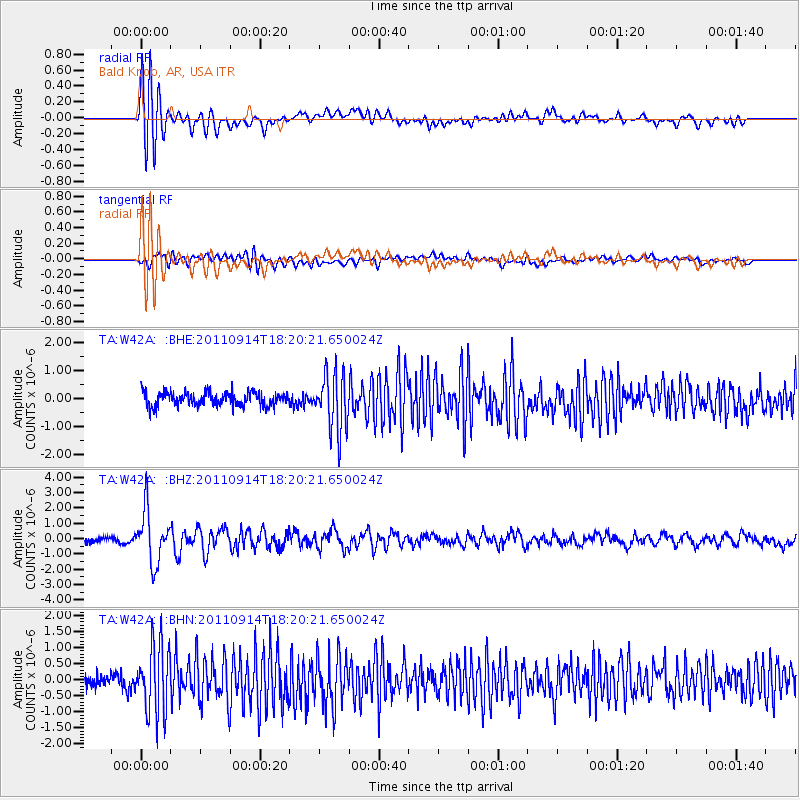
| Channel | StoN | STA | LTA |
| TA:W42A: :BHZ:20110914T18:20:21.650024Z | 8.691219 | 1.6948383E-6 | 1.9500581E-7 |
| TA:W42A: :BHN:20110914T18:20:21.650024Z | 6.0533814 | 1.0771387E-6 | 1.7794E-7 |
| TA:W42A: :BHE:20110914T18:20:21.650024Z | 4.1834054 | 1.0372543E-6 | 2.4794497E-7 |
| Arrivals | |
| Ps | 3.0 SECOND |
| PpPs | 10.0 SECOND |
| PsPs/PpSs | 13 SECOND |

