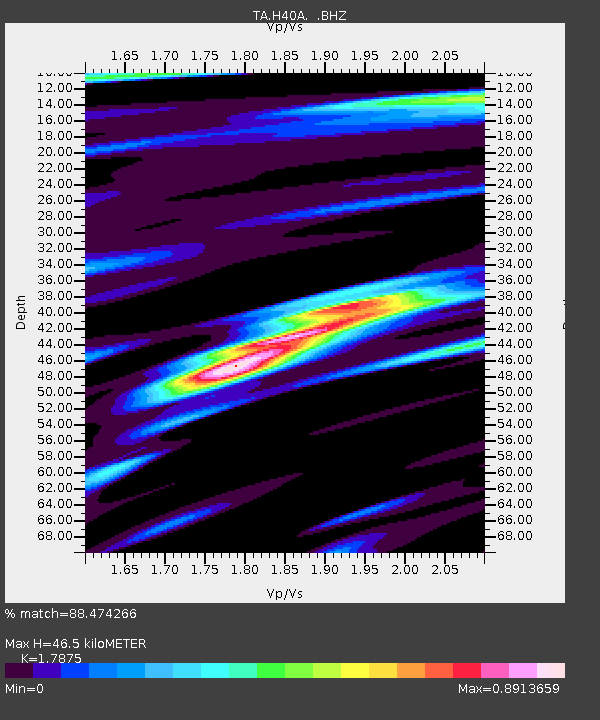
H40A Chili, WI, USA - Earthquake Result Viewer
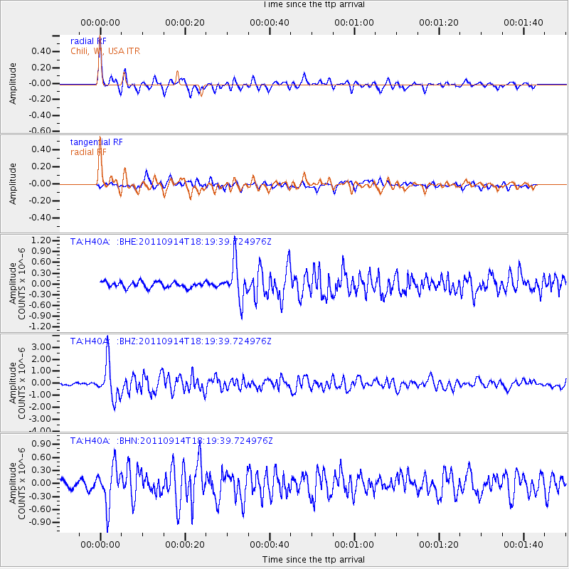
Earthquake location: Near Islands, Aleutian Islands
Earthquake latitude/longitude: 53.1/173.0
Earthquake time(UTC): 2011/09/14 (257) 18:10:09 GMT
Earthquake Depth: 15 km
Earthquake Magnitude: 6.1 MB, 5.7 MS, 6.0 MW, 6.0 MW
Earthquake Catalog/Contributor: WHDF/NEIC
Network: TA USArray Transportable Network (new EarthScope stations)
Station: H40A Chili, WI, USA
Lat/Lon: 44.62 N/90.39 W
Elevation: 372 m
Distance: 59.4 deg
Az: 55.485 deg
Baz: 315.92 deg
Ray Param: 0.06219235
Estimated Moho Depth: 46.5 km
Estimated Crust Vp/Vs: 1.79
Assumed Crust Vp: 6.571 km/s
Estimated Crust Vs: 3.676 km/s
Estimated Crust Poisson's Ratio: 0.27
Radial Match: 88.474266 %
Radial Bump: 400
Transverse Match: 78.83875 %
Transverse Bump: 400
SOD ConfigId: 414626
Insert Time: 2012-01-23 11:02:21.009 +0000
GWidth: 2.5
Max Bumps: 400
Tol: 0.001

Signal To Noise

ChannelStoNSTALTA
TA:H40A: :BHZ:20110914T18:19:39.724976Z12.8248151.5360092E-61.1976853E-7
TA:H40A: :BHN:20110914T18:19:39.724976Z4.99947364.4711643E-78.9432696E-8
TA:H40A: :BHE:20110914T18:19:39.724976Z6.6000715.327421E-78.071763E-8
Arrivals
Ps5.9 SECOND
PpPs19 SECOND
PsPs/PpSs25 SECOND