H41A Junction City, WI, USA - Earthquake Result Viewer
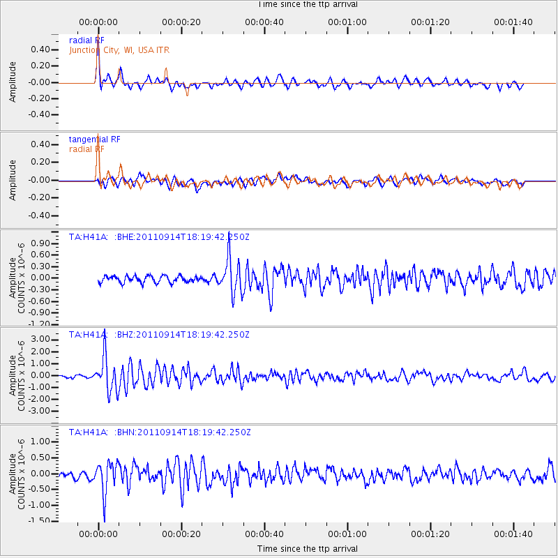
Earthquake location: Near Islands, Aleutian Islands
Earthquake latitude/longitude: 53.1/173.0
Earthquake time(UTC): 2011/09/14 (257) 18:10:09 GMT
Earthquake Depth: 15 km
Earthquake Magnitude: 6.1 MB, 5.7 MS, 6.0 MW, 6.0 MW
Earthquake Catalog/Contributor: WHDF/NEIC
Network: TA USArray Transportable Network (new EarthScope stations)
Station: H41A Junction City, WI, USA
Lat/Lon: 44.62 N/89.65 W
Elevation: 348 m
Distance: 59.8 deg
Az: 55.05 deg
Baz: 316.216 deg
Ray Param: 0.06194982
Estimated Moho Depth: 38.0 km
Estimated Crust Vp/Vs: 1.88
Assumed Crust Vp: 6.41 km/s
Estimated Crust Vs: 3.401 km/s
Estimated Crust Poisson's Ratio: 0.30
Radial Match: 85.93003 %
Radial Bump: 400
Transverse Match: 58.11891 %
Transverse Bump: 400
SOD ConfigId: 414626
Insert Time: 2012-01-23 11:03:01.336 +0000
GWidth: 2.5
Max Bumps: 400
Tol: 0.001

Signal To Noise

ChannelStoNSTALTA
TA:H41A: :BHZ:20110914T18:19:42.250Z12.0248561.4650842E-61.2183799E-7
TA:H41A: :BHN:20110914T18:19:42.250Z4.99140454.899071E-79.815015E-8
TA:H41A: :BHE:20110914T18:19:42.250Z5.4920514.616079E-78.4050185E-8
Arrivals
Ps5.5 SECOND
PpPs16 SECOND
PsPs/PpSs22 SECOND