F41A Wisconsin Rapids, WI, USA - Earthquake Result Viewer
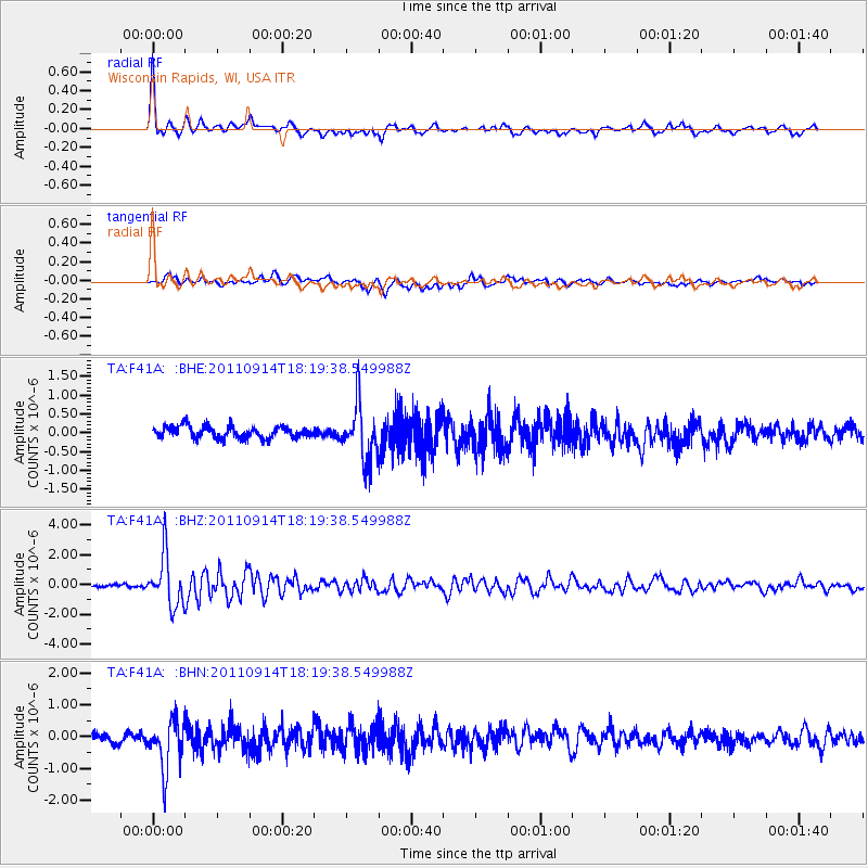
Earthquake location: Near Islands, Aleutian Islands
Earthquake latitude/longitude: 53.1/173.0
Earthquake time(UTC): 2011/09/14 (257) 18:10:09 GMT
Earthquake Depth: 15 km
Earthquake Magnitude: 6.1 MB, 5.7 MS, 6.0 MW, 6.0 MW
Earthquake Catalog/Contributor: WHDF/NEIC
Network: TA USArray Transportable Network (new EarthScope stations)
Station: F41A Wisconsin Rapids, WI, USA
Lat/Lon: 45.74 N/89.10 W
Elevation: 509 m
Distance: 59.2 deg
Az: 53.823 deg
Baz: 315.981 deg
Ray Param: 0.062305003
Estimated Moho Depth: 55.0 km
Estimated Crust Vp/Vs: 1.60
Assumed Crust Vp: 6.41 km/s
Estimated Crust Vs: 4.006 km/s
Estimated Crust Poisson's Ratio: 0.18
Radial Match: 89.72662 %
Radial Bump: 400
Transverse Match: 55.809494 %
Transverse Bump: 400
SOD ConfigId: 414626
Insert Time: 2012-01-23 11:04:38.228 +0000
GWidth: 2.5
Max Bumps: 400
Tol: 0.001

Signal To Noise

ChannelStoNSTALTA
TA:F41A: :BHZ:20110914T18:19:38.549988Z11.7500991.688688E-61.4371692E-7
TA:F41A: :BHN:20110914T18:19:38.549988Z4.7262147.9528326E-71.6827069E-7
TA:F41A: :BHE:20110914T18:19:38.549988Z4.7336427.4062297E-71.5645944E-7
Arrivals
Ps5.4 SECOND
PpPs21 SECOND
PsPs/PpSs27 SECOND