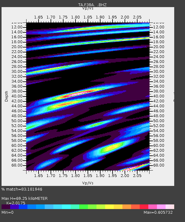
F39A Loretta, WI, USA - Earthquake Result Viewer
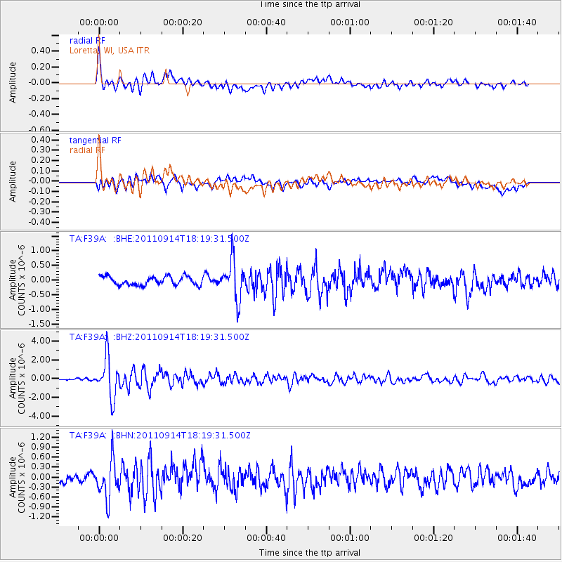
Earthquake location: Near Islands, Aleutian Islands
Earthquake latitude/longitude: 53.1/173.0
Earthquake time(UTC): 2011/09/14 (257) 18:10:09 GMT
Earthquake Depth: 15 km
Earthquake Magnitude: 6.1 MB, 5.7 MS, 6.0 MW, 6.0 MW
Earthquake Catalog/Contributor: WHDF/NEIC
Network: TA USArray Transportable Network (new EarthScope stations)
Station: F39A Loretta, WI, USA
Lat/Lon: 45.92 N/90.92 W
Elevation: 440 m
Distance: 58.2 deg
Az: 54.738 deg
Baz: 315.159 deg
Ray Param: 0.06296843
Estimated Moho Depth: 69.25 km
Estimated Crust Vp/Vs: 2.02
Assumed Crust Vp: 6.571 km/s
Estimated Crust Vs: 3.257 km/s
Estimated Crust Poisson's Ratio: 0.34
Radial Match: 83.181946 %
Radial Bump: 400
Transverse Match: 68.9696 %
Transverse Bump: 400
SOD ConfigId: 414626
Insert Time: 2012-01-23 11:04:50.711 +0000
GWidth: 2.5
Max Bumps: 400
Tol: 0.001

Signal To Noise

ChannelStoNSTALTA
TA:F39A: :BHZ:20110914T18:19:31.500Z15.7808942.1719952E-61.3763447E-7
TA:F39A: :BHN:20110914T18:19:31.500Z4.6076755.8043383E-71.259711E-7
TA:F39A: :BHE:20110914T18:19:31.500Z4.70573766.827428E-71.4508731E-7
Arrivals
Ps11 SECOND
PpPs30 SECOND
PsPs/PpSs42 SECOND