You are here: Home > Network List > UW - Pacific Northwest Regional Seismic Network Stations List
> Station MRBL Marblemount, WA, USA > Earthquake Result Viewer
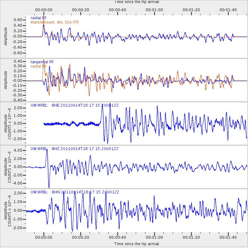
MRBL Marblemount, WA, USA - Earthquake Result Viewer
*The percent match for this event was below the threshold and hence no stack was calculated.
| Earthquake location: |
Near Islands, Aleutian Islands |
| Earthquake latitude/longitude: |
53.1/173.0 |
| Earthquake time(UTC): |
2011/09/14 (257) 18:10:09 GMT |
| Earthquake Depth: |
15 km |
| Earthquake Magnitude: |
6.1 MB, 5.7 MS, 6.0 MW, 6.0 MW |
| Earthquake Catalog/Contributor: |
WHDF/NEIC |
|
| Network: |
UW Pacific Northwest Regional Seismic Network |
| Station: |
MRBL Marblemount, WA, USA |
| Lat/Lon: |
48.52 N/121.48 W |
| Elevation: |
75 m |
|
| Distance: |
40.4 deg |
| Az: |
69.138 deg |
| Baz: |
302.077 deg |
| Ray Param: |
$rayparam |
*The percent match for this event was below the threshold and hence was not used in the summary stack. |
|
| Radial Match: |
65.83301 % |
| Radial Bump: |
400 |
| Transverse Match: |
81.61385 % |
| Transverse Bump: |
400 |
| SOD ConfigId: |
414626 |
| Insert Time: |
2012-01-23 11:06:25.796 +0000 |
| GWidth: |
2.5 |
| Max Bumps: |
400 |
| Tol: |
0.001 |
|
Signal To Noise
| Channel | StoN | STA | LTA |
| UW:MRBL: :BHZ:20110914T18:17:15.200012Z | 22.824566 | 2.1614153E-6 | 9.469688E-8 |
| UW:MRBL: :BHN:20110914T18:17:15.200012Z | 6.8604794 | 6.9589777E-7 | 1.0143574E-7 |
| UW:MRBL: :BHE:20110914T18:17:15.200012Z | 11.491308 | 1.2838092E-6 | 1.1172003E-7 |
| Arrivals |
| Ps | |
| PpPs | |
| PsPs/PpSs | |


