You are here: Home > Network List > UW - Pacific Northwest Regional Seismic Network Stations List
> Station LEBA Lebam, WA, USA > Earthquake Result Viewer
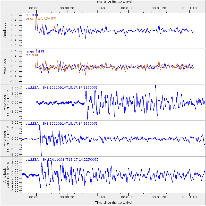
LEBA Lebam, WA, USA - Earthquake Result Viewer
*The percent match for this event was below the threshold and hence no stack was calculated.
| Earthquake location: |
Near Islands, Aleutian Islands |
| Earthquake latitude/longitude: |
53.1/173.0 |
| Earthquake time(UTC): |
2011/09/14 (257) 18:10:09 GMT |
| Earthquake Depth: |
15 km |
| Earthquake Magnitude: |
6.1 MB, 5.7 MS, 6.0 MW, 6.0 MW |
| Earthquake Catalog/Contributor: |
WHDF/NEIC |
|
| Network: |
UW Pacific Northwest Regional Seismic Network |
| Station: |
LEBA Lebam, WA, USA |
| Lat/Lon: |
46.55 N/123.56 W |
| Elevation: |
73 m |
|
| Distance: |
40.2 deg |
| Az: |
72.882 deg |
| Baz: |
303.403 deg |
| Ray Param: |
$rayparam |
*The percent match for this event was below the threshold and hence was not used in the summary stack. |
|
| Radial Match: |
69.33814 % |
| Radial Bump: |
400 |
| Transverse Match: |
75.24817 % |
| Transverse Bump: |
400 |
| SOD ConfigId: |
414626 |
| Insert Time: |
2012-01-23 11:06:40.419 +0000 |
| GWidth: |
2.5 |
| Max Bumps: |
400 |
| Tol: |
0.001 |
|
Signal To Noise
| Channel | StoN | STA | LTA |
| UW:LEBA: :BHZ:20110914T18:17:14.225006Z | 16.64886 | 3.8085536E-6 | 2.2875761E-7 |
| UW:LEBA: :BHN:20110914T18:17:14.225006Z | 3.437295 | 1.3597187E-6 | 3.9557813E-7 |
| UW:LEBA: :BHE:20110914T18:17:14.225006Z | 7.0938334 | 1.4183358E-6 | 1.9993925E-7 |
| Arrivals |
| Ps | |
| PpPs | |
| PsPs/PpSs | |


