You are here: Home > Network List > CI - Caltech Regional Seismic Network Stations List
> Station SMM Simmler, CA, USA > Earthquake Result Viewer
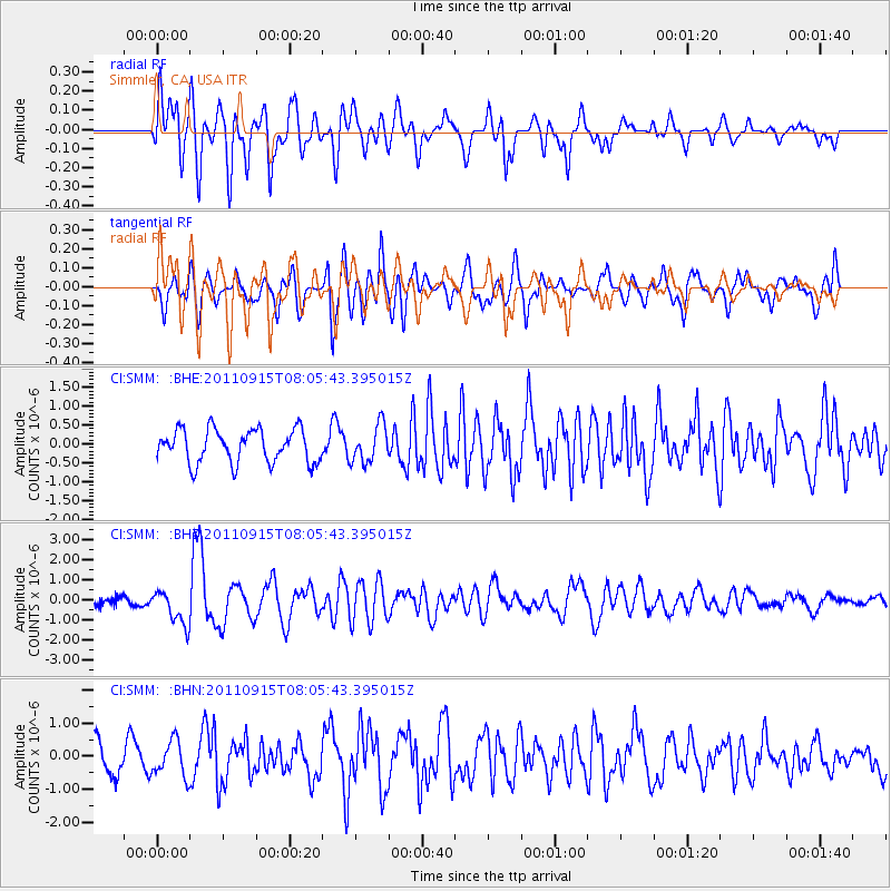
SMM Simmler, CA, USA - Earthquake Result Viewer
*The percent match for this event was below the threshold and hence no stack was calculated.
| Earthquake location: |
East Of North Island, N.Z. |
| Earthquake latitude/longitude: |
-35.4/-179.0 |
| Earthquake time(UTC): |
2011/09/15 (258) 07:53:18 GMT |
| Earthquake Depth: |
10 km |
| Earthquake Magnitude: |
6.0 MB, 6.2 MS, 6.1 MW, 6.0 MW |
| Earthquake Catalog/Contributor: |
WHDF/NEIC |
|
| Network: |
CI Caltech Regional Seismic Network |
| Station: |
SMM Simmler, CA, USA |
| Lat/Lon: |
35.31 N/120.00 W |
| Elevation: |
599 m |
|
| Distance: |
89.3 deg |
| Az: |
44.538 deg |
| Baz: |
224.502 deg |
| Ray Param: |
$rayparam |
*The percent match for this event was below the threshold and hence was not used in the summary stack. |
|
| Radial Match: |
71.05575 % |
| Radial Bump: |
400 |
| Transverse Match: |
67.80552 % |
| Transverse Bump: |
400 |
| SOD ConfigId: |
414626 |
| Insert Time: |
2012-01-23 11:18:28.821 +0000 |
| GWidth: |
2.5 |
| Max Bumps: |
400 |
| Tol: |
0.001 |
|
Signal To Noise
| Channel | StoN | STA | LTA |
| CI:SMM: :BHZ:20110915T08:05:43.395015Z | 2.6939814 | 8.461827E-7 | 3.1410116E-7 |
| CI:SMM: :BHN:20110915T08:05:43.395015Z | 1.1985109 | 5.3744657E-7 | 4.484286E-7 |
| CI:SMM: :BHE:20110915T08:05:43.395015Z | 1.1178026 | 4.9313405E-7 | 4.4116382E-7 |
| Arrivals |
| Ps | |
| PpPs | |
| PsPs/PpSs | |


