You are here: Home > Network List > TA - USArray Transportable Network (new EarthScope stations) Stations List
> Station C06D Leavenworth, WQ, USA > Earthquake Result Viewer
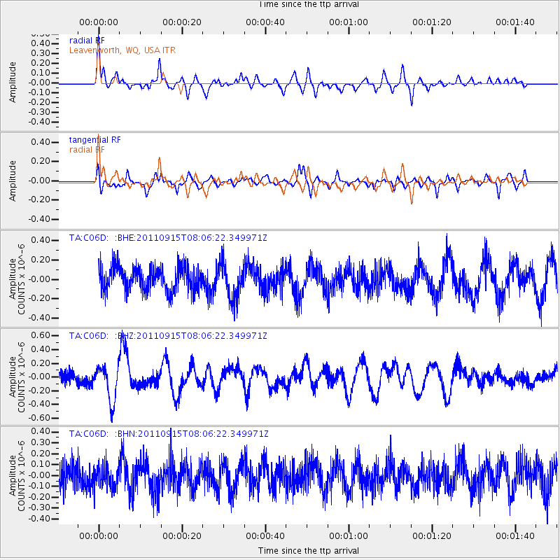
C06D Leavenworth, WQ, USA - Earthquake Result Viewer
*The percent match for this event was below the threshold and hence no stack was calculated.
| Earthquake location: |
East Of North Island, N.Z. |
| Earthquake latitude/longitude: |
-35.4/-179.0 |
| Earthquake time(UTC): |
2011/09/15 (258) 07:53:18 GMT |
| Earthquake Depth: |
10 km |
| Earthquake Magnitude: |
6.0 MB, 6.2 MS, 6.1 MW, 6.0 MW |
| Earthquake Catalog/Contributor: |
WHDF/NEIC |
|
| Network: |
TA USArray Transportable Network (new EarthScope stations) |
| Station: |
C06D Leavenworth, WQ, USA |
| Lat/Lon: |
47.92 N/120.89 W |
| Elevation: |
544 m |
|
| Distance: |
97.8 deg |
| Az: |
35.217 deg |
| Baz: |
224.486 deg |
| Ray Param: |
$rayparam |
*The percent match for this event was below the threshold and hence was not used in the summary stack. |
|
| Radial Match: |
77.07993 % |
| Radial Bump: |
400 |
| Transverse Match: |
72.258 % |
| Transverse Bump: |
364 |
| SOD ConfigId: |
414626 |
| Insert Time: |
2012-01-23 11:25:26.885 +0000 |
| GWidth: |
2.5 |
| Max Bumps: |
400 |
| Tol: |
0.001 |
|
Signal To Noise
| Channel | StoN | STA | LTA |
| TA:C06D: :BHZ:20110915T08:06:22.349971Z | 3.0011494 | 2.6804796E-7 | 8.93151E-8 |
| TA:C06D: :BHN:20110915T08:06:22.349971Z | 0.92091405 | 9.836136E-8 | 1.068084E-7 |
| TA:C06D: :BHE:20110915T08:06:22.349971Z | 1.5637431 | 1.9363739E-7 | 1.2382942E-7 |
| Arrivals |
| Ps | |
| PpPs | |
| PsPs/PpSs | |


