You are here: Home > Network List > TA - USArray Transportable Network (new EarthScope stations) Stations List
> Station J32A Parkston, SD, USA > Earthquake Result Viewer
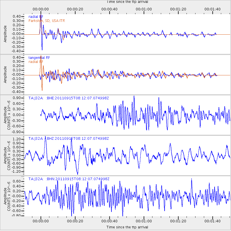
J32A Parkston, SD, USA - Earthquake Result Viewer
*The percent match for this event was below the threshold and hence no stack was calculated.
| Earthquake location: |
Near East Coast Of Honshu, Japan |
| Earthquake latitude/longitude: |
36.3/141.3 |
| Earthquake time(UTC): |
2011/09/15 (258) 08:00:09 GMT |
| Earthquake Depth: |
28 km |
| Earthquake Magnitude: |
5.8 MB, 6.0 MS, 6.2 MW, 6.1 MW |
| Earthquake Catalog/Contributor: |
WHDF/NEIC |
|
| Network: |
TA USArray Transportable Network (new EarthScope stations) |
| Station: |
J32A Parkston, SD, USA |
| Lat/Lon: |
43.37 N/97.85 W |
| Elevation: |
399 m |
|
| Distance: |
84.2 deg |
| Az: |
39.012 deg |
| Baz: |
315.754 deg |
| Ray Param: |
$rayparam |
*The percent match for this event was below the threshold and hence was not used in the summary stack. |
|
| Radial Match: |
68.29366 % |
| Radial Bump: |
400 |
| Transverse Match: |
56.8583 % |
| Transverse Bump: |
400 |
| SOD ConfigId: |
414626 |
| Insert Time: |
2012-01-23 11:45:46.804 +0000 |
| GWidth: |
2.5 |
| Max Bumps: |
400 |
| Tol: |
0.001 |
|
Signal To Noise
| Channel | StoN | STA | LTA |
| TA:J32A: :BHZ:20110915T08:12:07.074998Z | 2.3260853 | 5.757814E-7 | 2.4753237E-7 |
| TA:J32A: :BHN:20110915T08:12:07.074998Z | 1.3980508 | 1.7951787E-7 | 1.2840583E-7 |
| TA:J32A: :BHE:20110915T08:12:07.074998Z | 1.3899683 | 2.2241736E-7 | 1.6001614E-7 |
| Arrivals |
| Ps | |
| PpPs | |
| PsPs/PpSs | |


