You are here: Home > Network List > TA - USArray Transportable Network (new EarthScope stations) Stations List
> Station F36A Milaca, MN, USA > Earthquake Result Viewer
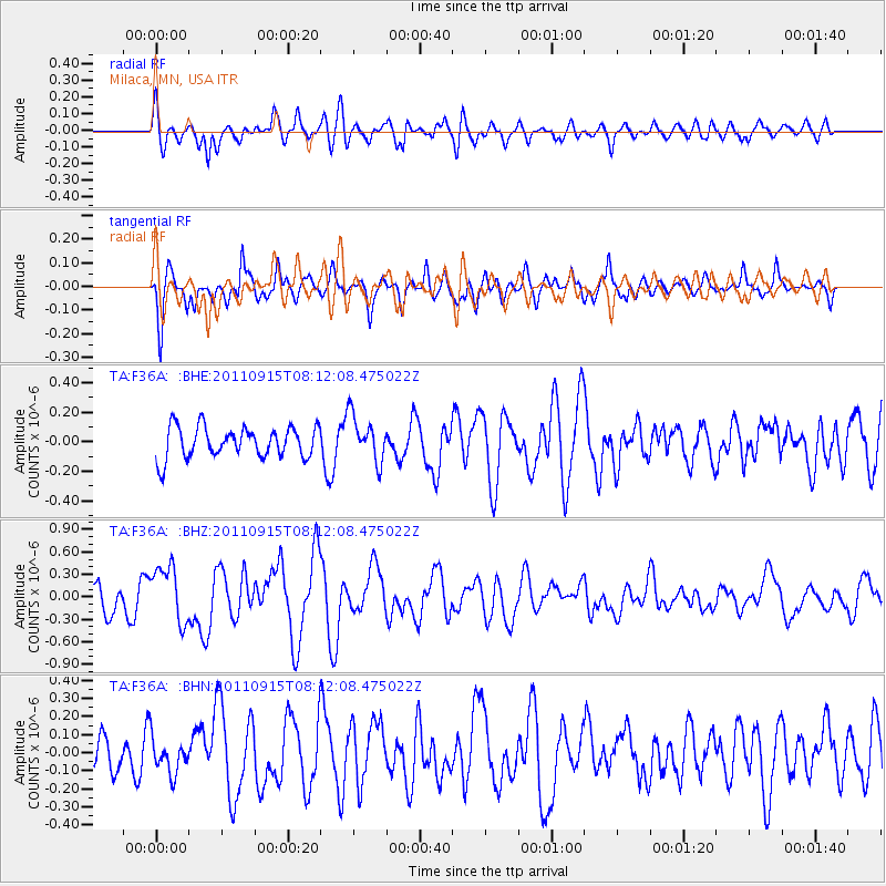
F36A Milaca, MN, USA - Earthquake Result Viewer
*The percent match for this event was below the threshold and hence no stack was calculated.
| Earthquake location: |
Near East Coast Of Honshu, Japan |
| Earthquake latitude/longitude: |
36.3/141.3 |
| Earthquake time(UTC): |
2011/09/15 (258) 08:00:09 GMT |
| Earthquake Depth: |
28 km |
| Earthquake Magnitude: |
5.8 MB, 6.0 MS, 6.2 MW, 6.1 MW |
| Earthquake Catalog/Contributor: |
WHDF/NEIC |
|
| Network: |
TA USArray Transportable Network (new EarthScope stations) |
| Station: |
F36A Milaca, MN, USA |
| Lat/Lon: |
45.86 N/93.52 W |
| Elevation: |
345 m |
|
| Distance: |
84.5 deg |
| Az: |
35.037 deg |
| Baz: |
318.39 deg |
| Ray Param: |
$rayparam |
*The percent match for this event was below the threshold and hence was not used in the summary stack. |
|
| Radial Match: |
64.22282 % |
| Radial Bump: |
400 |
| Transverse Match: |
67.88372 % |
| Transverse Bump: |
400 |
| SOD ConfigId: |
414626 |
| Insert Time: |
2012-01-23 11:49:46.514 +0000 |
| GWidth: |
2.5 |
| Max Bumps: |
400 |
| Tol: |
0.001 |
|
Signal To Noise
| Channel | StoN | STA | LTA |
| TA:F36A: :BHZ:20110915T08:12:08.475022Z | 2.3466804 | 3.7697896E-7 | 1.6064351E-7 |
| TA:F36A: :BHN:20110915T08:12:08.475022Z | 1.2138227 | 9.200596E-8 | 7.579852E-8 |
| TA:F36A: :BHE:20110915T08:12:08.475022Z | 1.4990212 | 1.5616365E-7 | 1.0417708E-7 |
| Arrivals |
| Ps | |
| PpPs | |
| PsPs/PpSs | |


