You are here: Home > Network List > TA - USArray Transportable Network (new EarthScope stations) Stations List
> Station K40A Colesburg, IA, USA > Earthquake Result Viewer
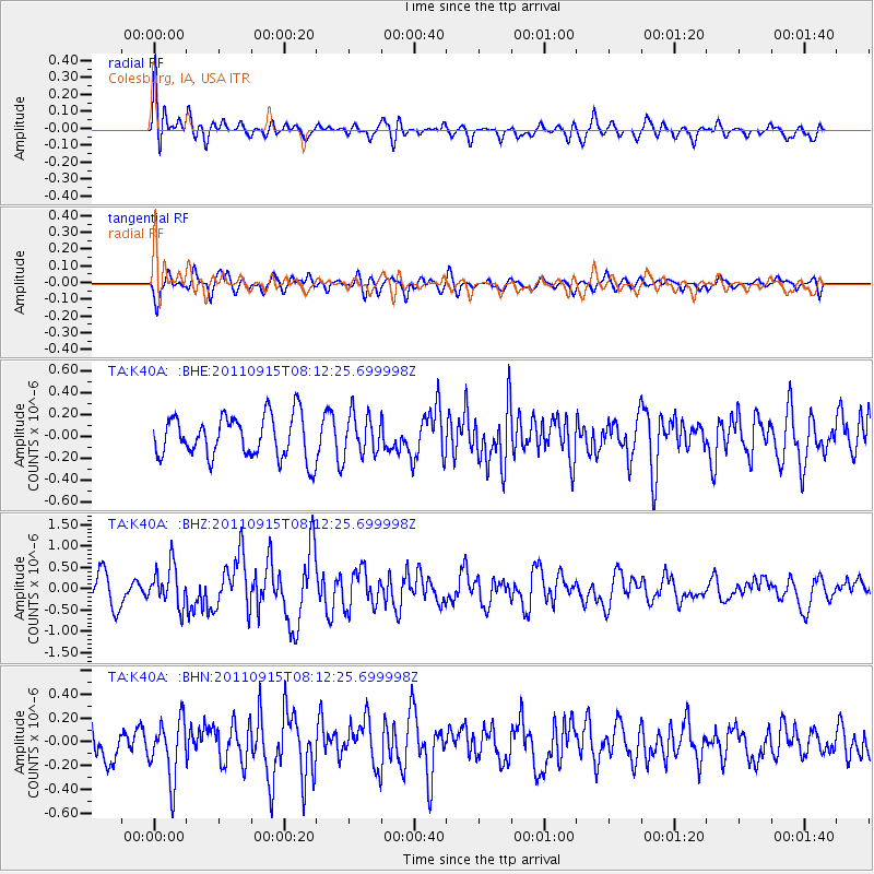
K40A Colesburg, IA, USA - Earthquake Result Viewer
*The percent match for this event was below the threshold and hence no stack was calculated.
| Earthquake location: |
Near East Coast Of Honshu, Japan |
| Earthquake latitude/longitude: |
36.3/141.3 |
| Earthquake time(UTC): |
2011/09/15 (258) 08:00:09 GMT |
| Earthquake Depth: |
28 km |
| Earthquake Magnitude: |
5.8 MB, 6.0 MS, 6.2 MW, 6.1 MW |
| Earthquake Catalog/Contributor: |
WHDF/NEIC |
|
| Network: |
TA USArray Transportable Network (new EarthScope stations) |
| Station: |
K40A Colesburg, IA, USA |
| Lat/Lon: |
42.70 N/91.14 W |
| Elevation: |
274 m |
|
| Distance: |
88.0 deg |
| Az: |
35.804 deg |
| Baz: |
320.101 deg |
| Ray Param: |
$rayparam |
*The percent match for this event was below the threshold and hence was not used in the summary stack. |
|
| Radial Match: |
63.29109 % |
| Radial Bump: |
400 |
| Transverse Match: |
65.425995 % |
| Transverse Bump: |
400 |
| SOD ConfigId: |
414626 |
| Insert Time: |
2012-01-23 11:56:06.764 +0000 |
| GWidth: |
2.5 |
| Max Bumps: |
400 |
| Tol: |
0.001 |
|
Signal To Noise
| Channel | StoN | STA | LTA |
| TA:K40A: :BHZ:20110915T08:12:25.699998Z | 1.3641871 | 4.6990286E-7 | 3.444563E-7 |
| TA:K40A: :BHN:20110915T08:12:25.699998Z | 1.6596603 | 2.4706512E-7 | 1.4886486E-7 |
| TA:K40A: :BHE:20110915T08:12:25.699998Z | 0.94937676 | 1.8262172E-7 | 1.9235958E-7 |
| Arrivals |
| Ps | |
| PpPs | |
| PsPs/PpSs | |


