You are here: Home > Network List > TA - USArray Transportable Network (new EarthScope stations) Stations List
> Station U41A Viola, AR, USA > Earthquake Result Viewer
U41A Viola, AR, USA - Earthquake Result Viewer
*The percent match for this event was below the threshold and hence no stack was calculated.
| Earthquake location: |
Near East Coast Of Honshu, Japan |
| Earthquake latitude/longitude: |
36.3/141.3 |
| Earthquake time(UTC): |
2011/09/15 (258) 08:00:09 GMT |
| Earthquake Depth: |
28 km |
| Earthquake Magnitude: |
5.8 MB, 6.0 MS, 6.2 MW, 6.1 MW |
| Earthquake Catalog/Contributor: |
WHDF/NEIC |
|
| Network: |
TA USArray Transportable Network (new EarthScope stations) |
| Station: |
U41A Viola, AR, USA |
| Lat/Lon: |
36.34 N/91.92 W |
| Elevation: |
300 m |
|
| Distance: |
92.5 deg |
| Az: |
40.359 deg |
| Baz: |
319.587 deg |
| Ray Param: |
$rayparam |
*The percent match for this event was below the threshold and hence was not used in the summary stack. |
|
| Radial Match: |
51.70208 % |
| Radial Bump: |
400 |
| Transverse Match: |
68.08441 % |
| Transverse Bump: |
400 |
| SOD ConfigId: |
414626 |
| Insert Time: |
2012-01-23 11:56:46.132 +0000 |
| GWidth: |
2.5 |
| Max Bumps: |
400 |
| Tol: |
0.001 |
|
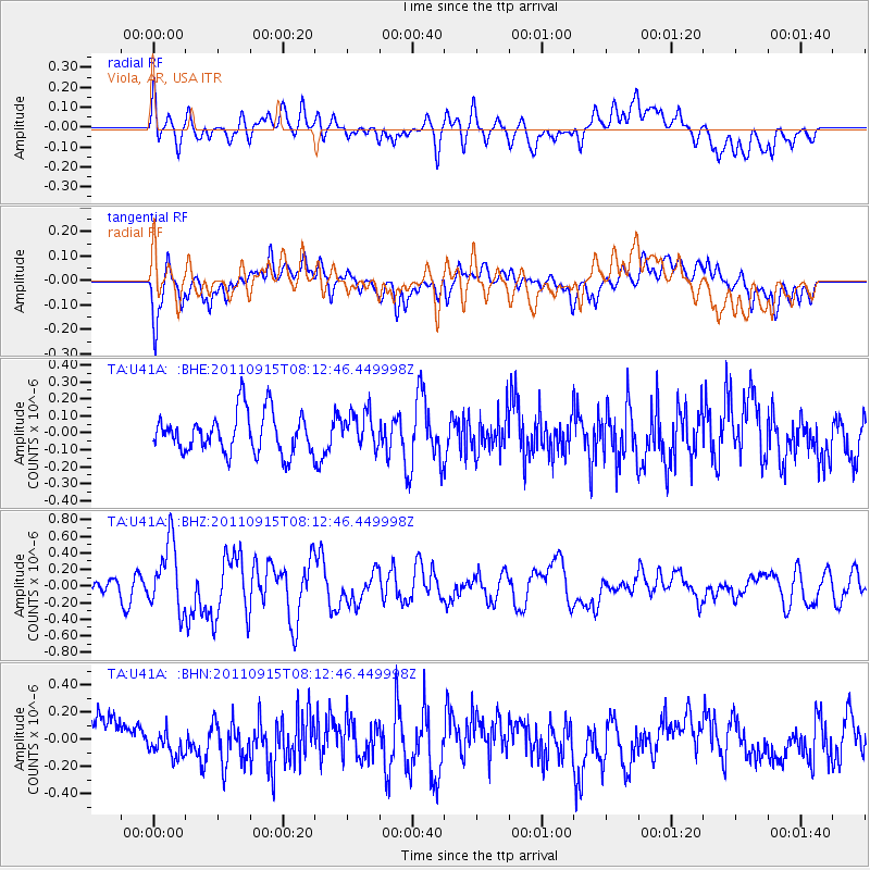
Signal To Noise
| Channel | StoN | STA | LTA |
| TA:U41A: :BHZ:20110915T08:12:46.449998Z | 3.1076932 | 4.0585505E-7 | 1.3059689E-7 |
| TA:U41A: :BHN:20110915T08:12:46.449998Z | 0.8567406 | 9.84535E-8 | 1.1491635E-7 |
| TA:U41A: :BHE:20110915T08:12:46.449998Z | 0.87689704 | 1.0319647E-7 | 1.1768368E-7 |
| Arrivals |
| Ps | |
| PpPs | |
| PsPs/PpSs | |


