You are here: Home > Network List > TA - USArray Transportable Network (new EarthScope stations) Stations List
> Station G40A Rib Lake, WI, USA > Earthquake Result Viewer
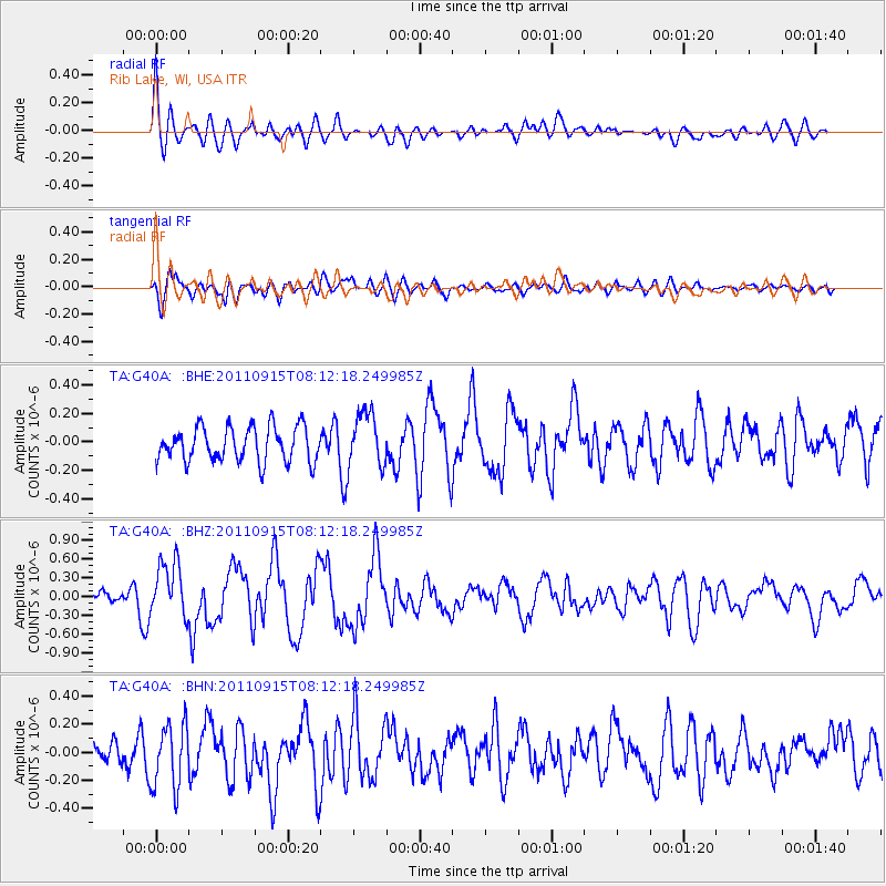
G40A Rib Lake, WI, USA - Earthquake Result Viewer
*The percent match for this event was below the threshold and hence no stack was calculated.
| Earthquake location: |
Near East Coast Of Honshu, Japan |
| Earthquake latitude/longitude: |
36.3/141.3 |
| Earthquake time(UTC): |
2011/09/15 (258) 08:00:09 GMT |
| Earthquake Depth: |
28 km |
| Earthquake Magnitude: |
5.8 MB, 6.0 MS, 6.2 MW, 6.1 MW |
| Earthquake Catalog/Contributor: |
WHDF/NEIC |
|
| Network: |
TA USArray Transportable Network (new EarthScope stations) |
| Station: |
G40A Rib Lake, WI, USA |
| Lat/Lon: |
45.27 N/90.20 W |
| Elevation: |
472 m |
|
| Distance: |
86.5 deg |
| Az: |
33.643 deg |
| Baz: |
320.646 deg |
| Ray Param: |
$rayparam |
*The percent match for this event was below the threshold and hence was not used in the summary stack. |
|
| Radial Match: |
67.036316 % |
| Radial Bump: |
400 |
| Transverse Match: |
57.603382 % |
| Transverse Bump: |
400 |
| SOD ConfigId: |
414626 |
| Insert Time: |
2012-01-23 11:58:14.973 +0000 |
| GWidth: |
2.5 |
| Max Bumps: |
400 |
| Tol: |
0.001 |
|
Signal To Noise
| Channel | StoN | STA | LTA |
| TA:G40A: :BHZ:20110915T08:12:18.249985Z | 3.7455087 | 4.3741366E-7 | 1.1678351E-7 |
| TA:G40A: :BHN:20110915T08:12:18.249985Z | 2.5569572 | 2.3102125E-7 | 9.0350056E-8 |
| TA:G40A: :BHE:20110915T08:12:18.249985Z | 1.5741589 | 1.9059244E-7 | 1.2107574E-7 |
| Arrivals |
| Ps | |
| PpPs | |
| PsPs/PpSs | |


