You are here: Home > Network List > CI - Caltech Regional Seismic Network Stations List
> Station MPM Manuel Prospect Mine, California, USA > Earthquake Result Viewer
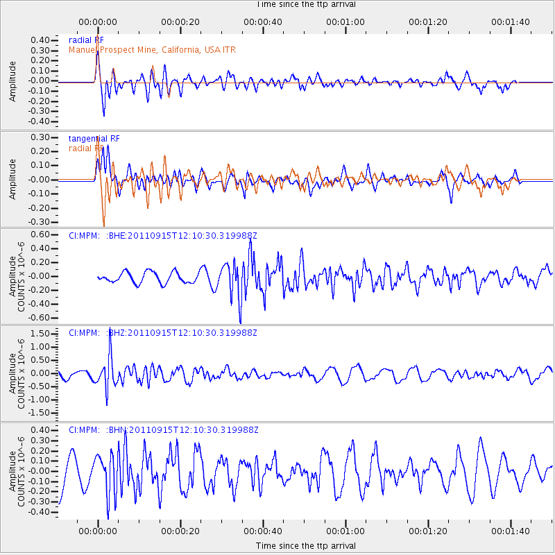
MPM Manuel Prospect Mine, California, USA - Earthquake Result Viewer
*The percent match for this event was below the threshold and hence no stack was calculated.
| Earthquake location: |
Fiji Islands Region |
| Earthquake latitude/longitude: |
-15.0/-178.0 |
| Earthquake time(UTC): |
2011/09/15 (258) 11:59:52 GMT |
| Earthquake Depth: |
378 km |
| Earthquake Magnitude: |
5.6 MB, 5.6 MW, 5.5 MW |
| Earthquake Catalog/Contributor: |
WHDF/NEIC |
|
| Network: |
CI Caltech Regional Seismic Network |
| Station: |
MPM Manuel Prospect Mine, California, USA |
| Lat/Lon: |
36.06 N/117.49 W |
| Elevation: |
185 m |
|
| Distance: |
76.4 deg |
| Az: |
46.508 deg |
| Baz: |
239.925 deg |
| Ray Param: |
$rayparam |
*The percent match for this event was below the threshold and hence was not used in the summary stack. |
|
| Radial Match: |
74.7744 % |
| Radial Bump: |
400 |
| Transverse Match: |
59.45889 % |
| Transverse Bump: |
400 |
| SOD ConfigId: |
414626 |
| Insert Time: |
2012-01-23 12:11:21.784 +0000 |
| GWidth: |
2.5 |
| Max Bumps: |
400 |
| Tol: |
0.001 |
|
Signal To Noise
| Channel | StoN | STA | LTA |
| CI:MPM: :BHZ:20110915T12:10:30.319988Z | 3.5435152 | 6.0302136E-7 | 1.7017604E-7 |
| CI:MPM: :BHN:20110915T12:10:30.319988Z | 0.9993544 | 1.9994282E-7 | 2.0007198E-7 |
| CI:MPM: :BHE:20110915T12:10:30.319988Z | 3.2885792 | 2.5432658E-7 | 7.733631E-8 |
| Arrivals |
| Ps | |
| PpPs | |
| PsPs/PpSs | |


