You are here: Home > Network List > CI - Caltech Regional Seismic Network Stations List
> Station SMM Simmler, CA, USA > Earthquake Result Viewer
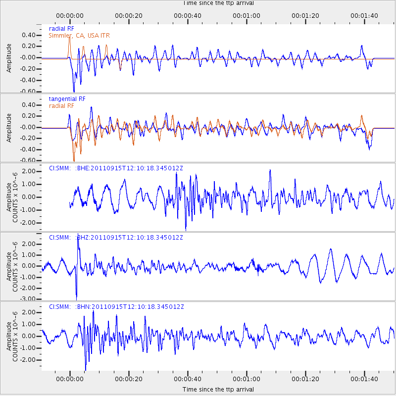
SMM Simmler, CA, USA - Earthquake Result Viewer
*The percent match for this event was below the threshold and hence no stack was calculated.
| Earthquake location: |
Fiji Islands Region |
| Earthquake latitude/longitude: |
-15.0/-178.0 |
| Earthquake time(UTC): |
2011/09/15 (258) 11:59:52 GMT |
| Earthquake Depth: |
378 km |
| Earthquake Magnitude: |
5.6 MB, 5.6 MW, 5.5 MW |
| Earthquake Catalog/Contributor: |
WHDF/NEIC |
|
| Network: |
CI Caltech Regional Seismic Network |
| Station: |
SMM Simmler, CA, USA |
| Lat/Lon: |
35.31 N/120.00 W |
| Elevation: |
599 m |
|
| Distance: |
74.2 deg |
| Az: |
46.085 deg |
| Baz: |
238.362 deg |
| Ray Param: |
$rayparam |
*The percent match for this event was below the threshold and hence was not used in the summary stack. |
|
| Radial Match: |
60.697987 % |
| Radial Bump: |
400 |
| Transverse Match: |
46.889305 % |
| Transverse Bump: |
400 |
| SOD ConfigId: |
414626 |
| Insert Time: |
2012-01-23 12:11:51.661 +0000 |
| GWidth: |
2.5 |
| Max Bumps: |
400 |
| Tol: |
0.001 |
|
Signal To Noise
| Channel | StoN | STA | LTA |
| CI:SMM: :BHZ:20110915T12:10:18.345012Z | 4.0152855 | 1.0690817E-6 | 2.6625295E-7 |
| CI:SMM: :BHN:20110915T12:10:18.345012Z | 1.8559262 | 6.522991E-7 | 3.5146826E-7 |
| CI:SMM: :BHE:20110915T12:10:18.345012Z | 0.90359825 | 5.8769524E-7 | 6.503944E-7 |
| Arrivals |
| Ps | |
| PpPs | |
| PsPs/PpSs | |


