You are here: Home > Network List > IW - Intermountain West Stations List
> Station MOOW Moose Ponds, Wyoming, USA > Earthquake Result Viewer
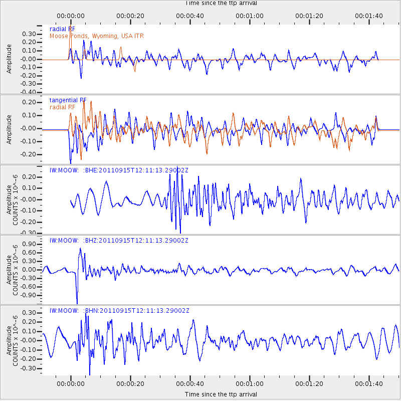
MOOW Moose Ponds, Wyoming, USA - Earthquake Result Viewer
*The percent match for this event was below the threshold and hence no stack was calculated.
| Earthquake location: |
Fiji Islands Region |
| Earthquake latitude/longitude: |
-15.0/-178.0 |
| Earthquake time(UTC): |
2011/09/15 (258) 11:59:52 GMT |
| Earthquake Depth: |
378 km |
| Earthquake Magnitude: |
5.6 MB, 5.6 MW, 5.5 MW |
| Earthquake Catalog/Contributor: |
WHDF/NEIC |
|
| Network: |
IW Intermountain West |
| Station: |
MOOW Moose Ponds, Wyoming, USA |
| Lat/Lon: |
43.75 N/110.74 W |
| Elevation: |
2128 m |
|
| Distance: |
84.6 deg |
| Az: |
42.155 deg |
| Baz: |
243.524 deg |
| Ray Param: |
$rayparam |
*The percent match for this event was below the threshold and hence was not used in the summary stack. |
|
| Radial Match: |
59.850372 % |
| Radial Bump: |
400 |
| Transverse Match: |
62.821507 % |
| Transverse Bump: |
400 |
| SOD ConfigId: |
414626 |
| Insert Time: |
2012-01-23 12:15:56.020 +0000 |
| GWidth: |
2.5 |
| Max Bumps: |
400 |
| Tol: |
0.001 |
|
Signal To Noise
| Channel | StoN | STA | LTA |
| IW:MOOW: :BHZ:20110915T12:11:13.29002Z | 6.473206 | 4.395315E-7 | 6.7900125E-8 |
| IW:MOOW: :BHN:20110915T12:11:13.29002Z | 1.4993645 | 8.69085E-8 | 5.7963558E-8 |
| IW:MOOW: :BHE:20110915T12:11:13.29002Z | 1.3853 | 8.886509E-8 | 6.414862E-8 |
| Arrivals |
| Ps | |
| PpPs | |
| PsPs/PpSs | |


