You are here: Home > Network List > TA - USArray Transportable Network (new EarthScope stations) Stations List
> Station R11A Troy Canyon, Currant, NV, USA > Earthquake Result Viewer
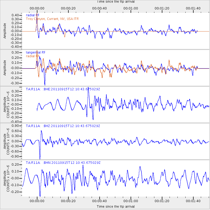
R11A Troy Canyon, Currant, NV, USA - Earthquake Result Viewer
*The percent match for this event was below the threshold and hence no stack was calculated.
| Earthquake location: |
Fiji Islands Region |
| Earthquake latitude/longitude: |
-15.0/-178.0 |
| Earthquake time(UTC): |
2011/09/15 (258) 11:59:52 GMT |
| Earthquake Depth: |
378 km |
| Earthquake Magnitude: |
5.6 MB, 5.6 MW, 5.5 MW |
| Earthquake Catalog/Contributor: |
WHDF/NEIC |
|
| Network: |
TA USArray Transportable Network (new EarthScope stations) |
| Station: |
R11A Troy Canyon, Currant, NV, USA |
| Lat/Lon: |
38.35 N/115.59 W |
| Elevation: |
1756 m |
|
| Distance: |
78.8 deg |
| Az: |
45.243 deg |
| Baz: |
240.8 deg |
| Ray Param: |
$rayparam |
*The percent match for this event was below the threshold and hence was not used in the summary stack. |
|
| Radial Match: |
74.82781 % |
| Radial Bump: |
400 |
| Transverse Match: |
80.38583 % |
| Transverse Bump: |
400 |
| SOD ConfigId: |
414626 |
| Insert Time: |
2012-01-23 12:17:52.085 +0000 |
| GWidth: |
2.5 |
| Max Bumps: |
400 |
| Tol: |
0.001 |
|
Signal To Noise
| Channel | StoN | STA | LTA |
| TA:R11A: :BHZ:20110915T12:10:43.675029Z | 2.4050653 | 3.516445E-7 | 1.4620996E-7 |
| TA:R11A: :BHN:20110915T12:10:43.675029Z | 0.94533265 | 1.0107767E-7 | 1.0692286E-7 |
| TA:R11A: :BHE:20110915T12:10:43.675029Z | 2.0274346 | 1.587174E-7 | 7.828484E-8 |
| Arrivals |
| Ps | |
| PpPs | |
| PsPs/PpSs | |


