You are here: Home > Network List > TA - USArray Transportable Network (new EarthScope stations) Stations List
> Station S37A Fort Scott, KS, USA > Earthquake Result Viewer
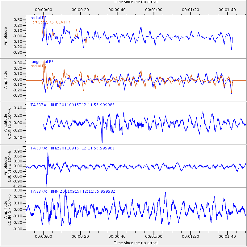
S37A Fort Scott, KS, USA - Earthquake Result Viewer
*The percent match for this event was below the threshold and hence no stack was calculated.
| Earthquake location: |
Fiji Islands Region |
| Earthquake latitude/longitude: |
-15.0/-178.0 |
| Earthquake time(UTC): |
2011/09/15 (258) 11:59:52 GMT |
| Earthquake Depth: |
378 km |
| Earthquake Magnitude: |
5.6 MB, 5.6 MW, 5.5 MW |
| Earthquake Catalog/Contributor: |
WHDF/NEIC |
|
| Network: |
TA USArray Transportable Network (new EarthScope stations) |
| Station: |
S37A Fort Scott, KS, USA |
| Lat/Lon: |
37.76 N/94.83 W |
| Elevation: |
260 m |
|
| Distance: |
93.7 deg |
| Az: |
52.049 deg |
| Baz: |
254.077 deg |
| Ray Param: |
$rayparam |
*The percent match for this event was below the threshold and hence was not used in the summary stack. |
|
| Radial Match: |
45.00974 % |
| Radial Bump: |
400 |
| Transverse Match: |
42.625954 % |
| Transverse Bump: |
400 |
| SOD ConfigId: |
414626 |
| Insert Time: |
2012-01-23 12:29:54.079 +0000 |
| GWidth: |
2.5 |
| Max Bumps: |
400 |
| Tol: |
0.001 |
|
Signal To Noise
| Channel | StoN | STA | LTA |
| TA:S37A: :BHZ:20110915T12:11:55.99998Z | 4.7004485 | 3.6759639E-7 | 7.820453E-8 |
| TA:S37A: :BHN:20110915T12:11:55.99998Z | 1.9864252 | 1.3128216E-7 | 6.608966E-8 |
| TA:S37A: :BHE:20110915T12:11:55.99998Z | 2.1364708 | 1.6986466E-7 | 7.950713E-8 |
| Arrivals |
| Ps | |
| PpPs | |
| PsPs/PpSs | |


