You are here: Home > Network List > TA - USArray Transportable Network (new EarthScope stations) Stations List
> Station E31A Nome, ND, USA > Earthquake Result Viewer
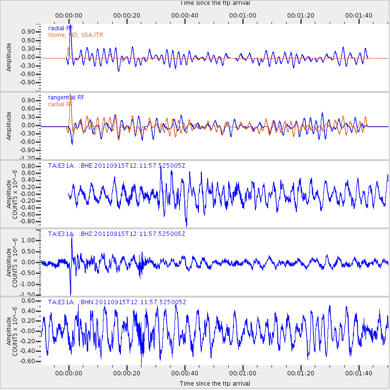
E31A Nome, ND, USA - Earthquake Result Viewer
*The percent match for this event was below the threshold and hence no stack was calculated.
| Earthquake location: |
Fiji Islands Region |
| Earthquake latitude/longitude: |
-15.0/-178.0 |
| Earthquake time(UTC): |
2011/09/15 (258) 11:59:52 GMT |
| Earthquake Depth: |
378 km |
| Earthquake Magnitude: |
5.6 MB, 5.6 MW, 5.5 MW |
| Earthquake Catalog/Contributor: |
WHDF/NEIC |
|
| Network: |
TA USArray Transportable Network (new EarthScope stations) |
| Station: |
E31A Nome, ND, USA |
| Lat/Lon: |
46.56 N/97.89 W |
| Elevation: |
427 m |
|
| Distance: |
94.0 deg |
| Az: |
42.954 deg |
| Baz: |
252.641 deg |
| Ray Param: |
$rayparam |
*The percent match for this event was below the threshold and hence was not used in the summary stack. |
|
| Radial Match: |
69.69651 % |
| Radial Bump: |
400 |
| Transverse Match: |
65.30734 % |
| Transverse Bump: |
400 |
| SOD ConfigId: |
414626 |
| Insert Time: |
2012-01-23 12:32:03.051 +0000 |
| GWidth: |
2.5 |
| Max Bumps: |
400 |
| Tol: |
0.001 |
|
Signal To Noise
| Channel | StoN | STA | LTA |
| TA:E31A: :BHZ:20110915T12:11:57.525005Z | 3.4720373 | 4.1716518E-7 | 1.2014998E-7 |
| TA:E31A: :BHN:20110915T12:11:57.525005Z | 0.98303276 | 2.2882897E-7 | 2.3277856E-7 |
| TA:E31A: :BHE:20110915T12:11:57.525005Z | 1.5458457 | 2.9401895E-7 | 1.901994E-7 |
| Arrivals |
| Ps | |
| PpPs | |
| PsPs/PpSs | |


