You are here: Home > Network List > TA - USArray Transportable Network (new EarthScope stations) Stations List
> Station T39A Clever, MO, USA > Earthquake Result Viewer
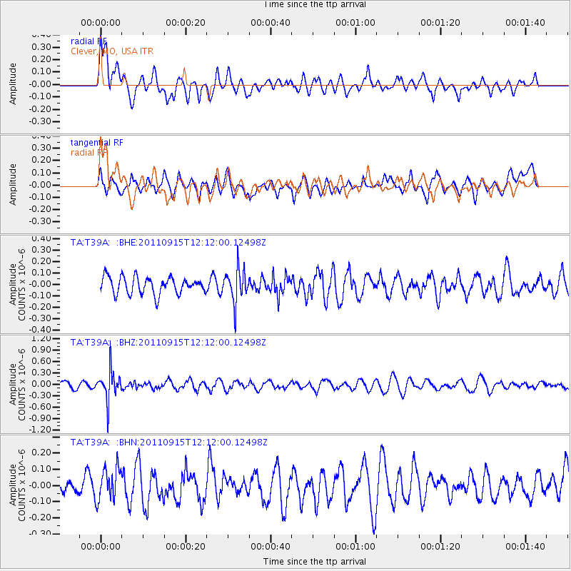
T39A Clever, MO, USA - Earthquake Result Viewer
*The percent match for this event was below the threshold and hence no stack was calculated.
| Earthquake location: |
Fiji Islands Region |
| Earthquake latitude/longitude: |
-15.0/-178.0 |
| Earthquake time(UTC): |
2011/09/15 (258) 11:59:52 GMT |
| Earthquake Depth: |
378 km |
| Earthquake Magnitude: |
5.6 MB, 5.6 MW, 5.5 MW |
| Earthquake Catalog/Contributor: |
WHDF/NEIC |
|
| Network: |
TA USArray Transportable Network (new EarthScope stations) |
| Station: |
T39A Clever, MO, USA |
| Lat/Lon: |
37.02 N/93.38 W |
| Elevation: |
366 m |
|
| Distance: |
94.6 deg |
| Az: |
53.068 deg |
| Baz: |
254.88 deg |
| Ray Param: |
$rayparam |
*The percent match for this event was below the threshold and hence was not used in the summary stack. |
|
| Radial Match: |
66.95514 % |
| Radial Bump: |
400 |
| Transverse Match: |
50.092155 % |
| Transverse Bump: |
400 |
| SOD ConfigId: |
414626 |
| Insert Time: |
2012-01-23 12:36:33.753 +0000 |
| GWidth: |
2.5 |
| Max Bumps: |
400 |
| Tol: |
0.001 |
|
Signal To Noise
| Channel | StoN | STA | LTA |
| TA:T39A: :BHZ:20110915T12:12:00.12498Z | 4.196632 | 4.0361462E-7 | 9.617584E-8 |
| TA:T39A: :BHN:20110915T12:12:00.12498Z | 1.5473329 | 1.01755745E-7 | 6.576203E-8 |
| TA:T39A: :BHE:20110915T12:12:00.12498Z | 1.978797 | 1.4572119E-7 | 7.36413E-8 |
| Arrivals |
| Ps | |
| PpPs | |
| PsPs/PpSs | |


