You are here: Home > Network List > TA - USArray Transportable Network (new EarthScope stations) Stations List
> Station 341A Kurthwood, LA, USA > Earthquake Result Viewer
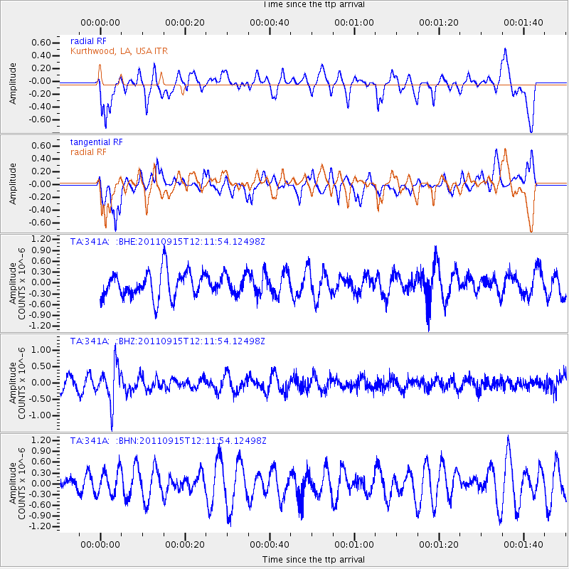
341A Kurthwood, LA, USA - Earthquake Result Viewer
*The percent match for this event was below the threshold and hence no stack was calculated.
| Earthquake location: |
Fiji Islands Region |
| Earthquake latitude/longitude: |
-15.0/-178.0 |
| Earthquake time(UTC): |
2011/09/15 (258) 11:59:52 GMT |
| Earthquake Depth: |
378 km |
| Earthquake Magnitude: |
5.6 MB, 5.6 MW, 5.5 MW |
| Earthquake Catalog/Contributor: |
WHDF/NEIC |
|
| Network: |
TA USArray Transportable Network (new EarthScope stations) |
| Station: |
341A Kurthwood, LA, USA |
| Lat/Lon: |
31.33 N/93.17 W |
| Elevation: |
93 m |
|
| Distance: |
93.3 deg |
| Az: |
58.603 deg |
| Baz: |
254.614 deg |
| Ray Param: |
$rayparam |
*The percent match for this event was below the threshold and hence was not used in the summary stack. |
|
| Radial Match: |
60.56905 % |
| Radial Bump: |
400 |
| Transverse Match: |
62.813435 % |
| Transverse Bump: |
400 |
| SOD ConfigId: |
414626 |
| Insert Time: |
2012-01-23 12:37:47.205 +0000 |
| GWidth: |
2.5 |
| Max Bumps: |
400 |
| Tol: |
0.001 |
|
Signal To Noise
| Channel | StoN | STA | LTA |
| TA:341A: :BHZ:20110915T12:11:54.12498Z | 2.2490592 | 5.7444345E-7 | 2.5541502E-7 |
| TA:341A: :BHN:20110915T12:11:54.12498Z | 1.1096417 | 3.47707E-7 | 3.1335068E-7 |
| TA:341A: :BHE:20110915T12:11:54.12498Z | 0.7772453 | 2.8609236E-7 | 3.6808507E-7 |
| Arrivals |
| Ps | |
| PpPs | |
| PsPs/PpSs | |


