You are here: Home > Network List > CI - Caltech Regional Seismic Network Stations List
> Station SHO Shoshone, CA, USA > Earthquake Result Viewer
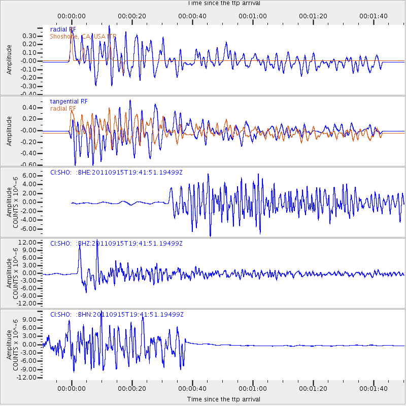
SHO Shoshone, CA, USA - Earthquake Result Viewer
*The percent match for this event was below the threshold and hence no stack was calculated.
| Earthquake location: |
Fiji Islands Region |
| Earthquake latitude/longitude: |
-21.6/-179.5 |
| Earthquake time(UTC): |
2011/09/15 (258) 19:31:04 GMT |
| Earthquake Depth: |
645 km |
| Earthquake Magnitude: |
6.1 MB, 7.3 MW, 7.3 MW |
| Earthquake Catalog/Contributor: |
WHDF/NEIC |
|
| Network: |
CI Caltech Regional Seismic Network |
| Station: |
SHO Shoshone, CA, USA |
| Lat/Lon: |
35.90 N/116.28 W |
| Elevation: |
451 m |
|
| Distance: |
82.7 deg |
| Az: |
46.961 deg |
| Baz: |
236.896 deg |
| Ray Param: |
$rayparam |
*The percent match for this event was below the threshold and hence was not used in the summary stack. |
|
| Radial Match: |
71.26658 % |
| Radial Bump: |
400 |
| Transverse Match: |
76.17537 % |
| Transverse Bump: |
400 |
| SOD ConfigId: |
414626 |
| Insert Time: |
2012-01-23 12:56:56.608 +0000 |
| GWidth: |
2.5 |
| Max Bumps: |
400 |
| Tol: |
0.001 |
|
Signal To Noise
| Channel | StoN | STA | LTA |
| CI:SHO: :BHZ:20110915T19:41:51.19499Z | 32.226776 | 4.0071477E-6 | 1.243422E-7 |
| CI:SHO: :BHN:20110915T19:41:51.19499Z | 5.569617 | 4.7838457E-6 | 8.5891827E-7 |
| CI:SHO: :BHE:20110915T19:41:51.19499Z | 8.351347 | 1.5256452E-6 | 1.8268253E-7 |
| Arrivals |
| Ps | |
| PpPs | |
| PsPs/PpSs | |


