You are here: Home > Network List > AV - Alaska Volcano Observatory Stations List
> Station SPCR Ckakachatna River, Mount Spurr, Alaska > Earthquake Result Viewer
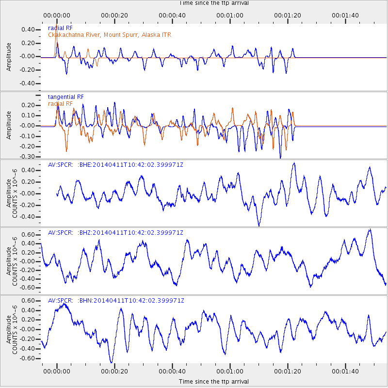
SPCR Ckakachatna River, Mount Spurr, Alaska - Earthquake Result Viewer
*The percent match for this event was below the threshold and hence no stack was calculated.
| Earthquake location: |
Solomon Islands |
| Earthquake latitude/longitude: |
-6.9/155.2 |
| Earthquake time(UTC): |
2014/04/11 (101) 10:30:32 GMT |
| Earthquake Depth: |
41 km |
| Earthquake Magnitude: |
5.1 mb |
| Earthquake Catalog/Contributor: |
ISC/ISC |
|
| Network: |
AV Alaska Volcano Observatory |
| Station: |
SPCR Ckakachatna River, Mount Spurr, Alaska |
| Lat/Lon: |
61.20 N/152.21 W |
| Elevation: |
984 m |
|
| Distance: |
79.2 deg |
| Az: |
23.064 deg |
| Baz: |
233.439 deg |
| Ray Param: |
$rayparam |
*The percent match for this event was below the threshold and hence was not used in the summary stack. |
|
| Radial Match: |
54.309116 % |
| Radial Bump: |
279 |
| Transverse Match: |
58.441666 % |
| Transverse Bump: |
400 |
| SOD ConfigId: |
3390531 |
| Insert Time: |
2019-04-11 07:01:32.346 +0000 |
| GWidth: |
2.5 |
| Max Bumps: |
400 |
| Tol: |
0.001 |
|
Signal To Noise
| Channel | StoN | STA | LTA |
| AV:SPCR: :BHZ:20140411T10:42:02.399971Z | 1.3313241 | 2.9051336E-7 | 2.1821386E-7 |
| AV:SPCR: :BHN:20140411T10:42:02.399971Z | 3.5305212 | 5.124727E-7 | 1.4515497E-7 |
| AV:SPCR: :BHE:20140411T10:42:02.399971Z | 1.5852222 | 1.7068689E-7 | 1.0767379E-7 |
| Arrivals |
| Ps | |
| PpPs | |
| PsPs/PpSs | |


