
BFS Mt Baldy Forest Station - Earthquake Result Viewer
| ||||||||||||||||||
| ||||||||||||||||||
| ||||||||||||||||||
|
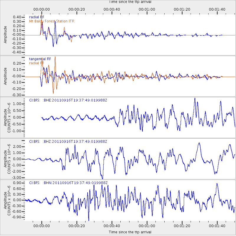
Signal To Noise
| Channel | StoN | STA | LTA |
| CI:BFS: :BHZ:20110916T19:37:49.019988Z | 0.54037064 | 1.2120864E-7 | 2.2430649E-7 |
| CI:BFS: :BHN:20110916T19:37:49.019988Z | 1.4809825 | 1.07657705E-7 | 7.269343E-8 |
| CI:BFS: :BHE:20110916T19:37:49.019988Z | 0.93969107 | 9.015082E-8 | 9.5936656E-8 |
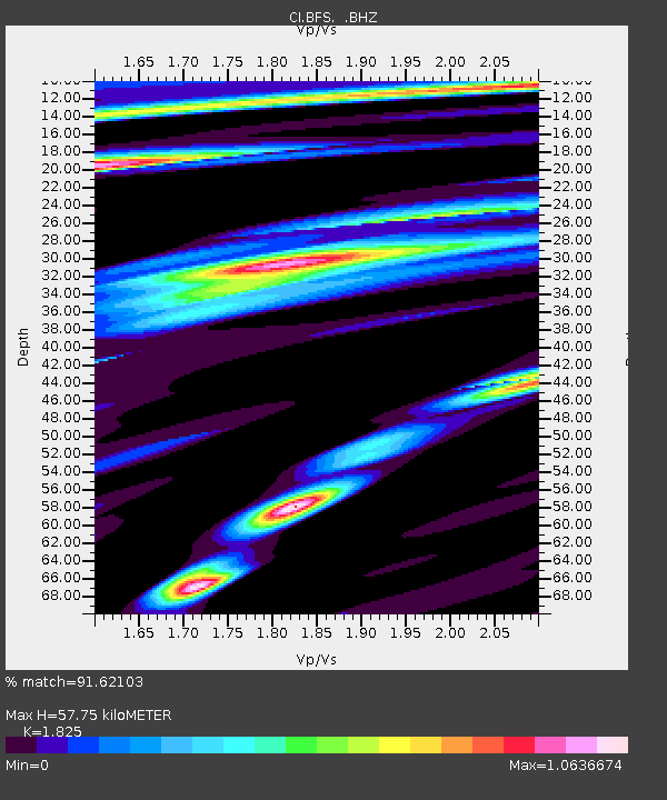
| Arrivals | |
| Ps | 7.8 SECOND |
| PpPs | 25 SECOND |
| PsPs/PpSs | 33 SECOND |

