QIZ Qiongzhong, Hainan Province, China - Earthquake Result Viewer
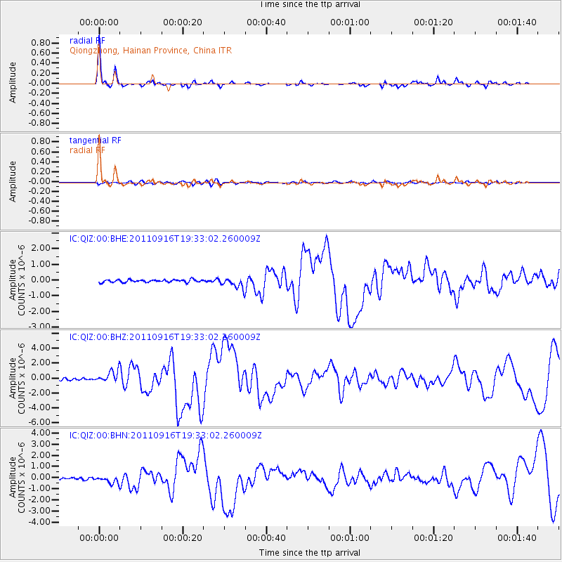
Earthquake location: Near East Coast Of Honshu, Japan
Earthquake latitude/longitude: 40.3/142.8
Earthquake time(UTC): 2011/09/16 (259) 19:26:40 GMT
Earthquake Depth: 35 km
Earthquake Magnitude: 6.0 MB, 6.5 MS, 6.7 MW, 6.7 MW
Earthquake Catalog/Contributor: WHDF/NEIC
Network: IC New China Digital Seismograph Network
Station: QIZ Qiongzhong, Hainan Province, China
Lat/Lon: 19.03 N/109.84 E
Elevation: 240 m
Distance: 35.3 deg
Az: 242.896 deg
Baz: 46.052 deg
Ray Param: 0.07723305
Estimated Moho Depth: 28.0 km
Estimated Crust Vp/Vs: 1.81
Assumed Crust Vp: 6.182 km/s
Estimated Crust Vs: 3.425 km/s
Estimated Crust Poisson's Ratio: 0.28
Radial Match: 95.690384 %
Radial Bump: 239
Transverse Match: 71.589836 %
Transverse Bump: 400
SOD ConfigId: 414626
Insert Time: 2012-01-23 13:45:14.611 +0000
GWidth: 2.5
Max Bumps: 400
Tol: 0.001

Signal To Noise

ChannelStoNSTALTA
IC:QIZ:00:BHZ:20110916T19:33:02.260009Z6.3298818.131296E-71.2845891E-7
IC:QIZ:00:BHN:20110916T19:33:02.260009Z4.3731093.2000594E-77.317585E-8
IC:QIZ:00:BHE:20110916T19:33:02.260009Z4.2642643.455983E-78.1045236E-8
Arrivals
Ps3.9 SECOND
PpPs12 SECOND
PsPs/PpSs16 SECOND