
GRFO Grafenberg, Germany - Earthquake Result Viewer
| ||||||||||||||||||
| ||||||||||||||||||
| ||||||||||||||||||
|
Signal To Noise
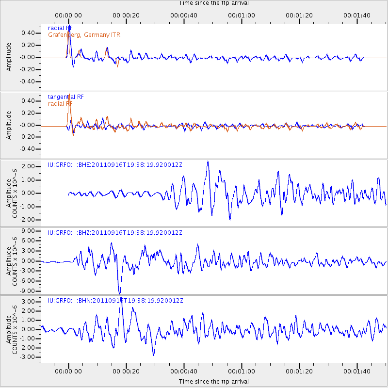
| Channel | StoN | STA | LTA |
| IU:GRFO: :BHZ:20110916T19:38:19.920012Z | 9.417828 | 1.0788862E-6 | 1.1455786E-7 |
| IU:GRFO: :BHN:20110916T19:38:19.920012Z | 2.5896811 | 4.0244936E-7 | 1.5540498E-7 |
| IU:GRFO: :BHE:20110916T19:38:19.920012Z | 1.6743019 | 2.0177507E-7 | 1.2051295E-7 |
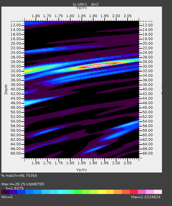
| Arrivals | |
| Ps | 4.5 SECOND |
| PpPs | 14 SECOND |
| PsPs/PpSs | 18 SECOND |

