
BGNE Belgrade, NE, USA - Earthquake Result Viewer
| ||||||||||||||||||
| ||||||||||||||||||
| ||||||||||||||||||
|
Signal To Noise
| Channel | StoN | STA | LTA |
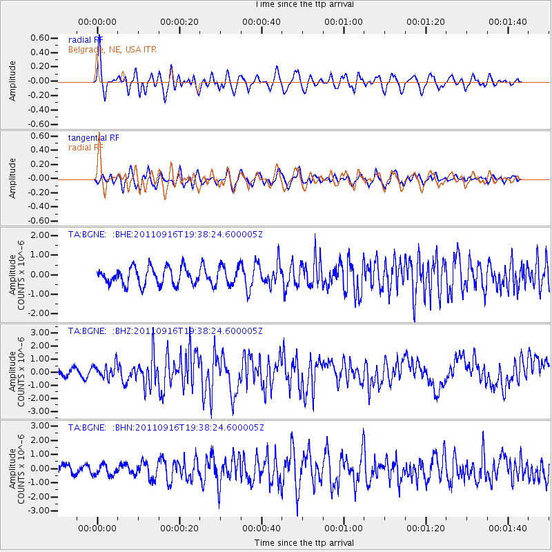
| TA:BGNE: :BHZ:20110916T19:38:24.600005Z | 2.4785597 | 5.4736813E-7 | 2.2084122E-7 |
| TA:BGNE: :BHN:20110916T19:38:24.600005Z | 0.9995069 | 3.690009E-7 | 3.6918294E-7 |
| TA:BGNE: :BHE:20110916T19:38:24.600005Z | 1.1163061 | 4.8505206E-7 | 4.3451527E-7 |
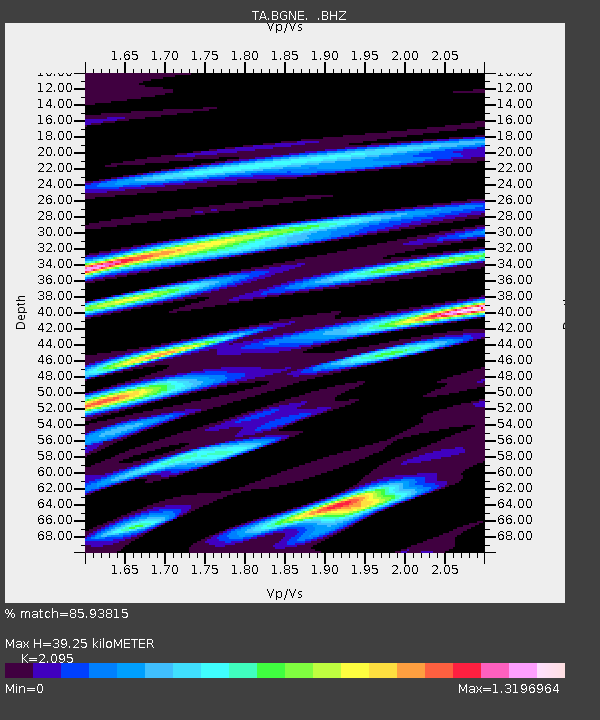
| Arrivals | |
| Ps | 6.7 SECOND |
| PpPs | 18 SECOND |
| PsPs/PpSs | 25 SECOND |

