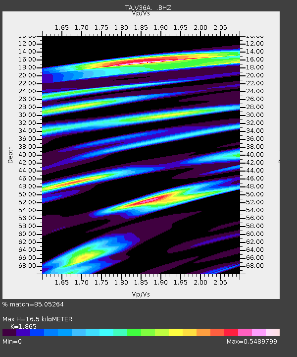
V36A Jenks, OK, USA - Earthquake Result Viewer
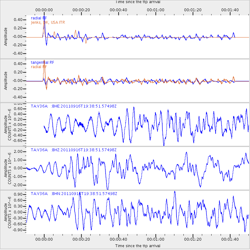
Earthquake location: Near East Coast Of Honshu, Japan
Earthquake latitude/longitude: 40.3/142.8
Earthquake time(UTC): 2011/09/16 (259) 19:26:40 GMT
Earthquake Depth: 35 km
Earthquake Magnitude: 6.0 MB, 6.5 MS, 6.7 MW, 6.7 MW
Earthquake Catalog/Contributor: WHDF/NEIC
Network: TA USArray Transportable Network (new EarthScope stations)
Station: V36A Jenks, OK, USA
Lat/Lon: 35.79 N/95.94 W
Elevation: 236 m
Distance: 87.0 deg
Az: 44.093 deg
Baz: 319.095 deg
Ray Param: 0.043574784
Estimated Moho Depth: 16.5 km
Estimated Crust Vp/Vs: 1.87
Assumed Crust Vp: 6.498 km/s
Estimated Crust Vs: 3.484 km/s
Estimated Crust Poisson's Ratio: 0.30
Radial Match: 85.05264 %
Radial Bump: 374
Transverse Match: 48.52849 %
Transverse Bump: 400
SOD ConfigId: 414626
Insert Time: 2012-01-23 13:56:02.459 +0000
GWidth: 2.5
Max Bumps: 400
Tol: 0.001

Signal To Noise

ChannelStoNSTALTA
TA:V36A: :BHZ:20110916T19:38:51.57498Z2.35688854.3064114E-71.8271595E-7
TA:V36A: :BHN:20110916T19:38:51.57498Z0.98655112.1322573E-72.1613248E-7
TA:V36A: :BHE:20110916T19:38:51.57498Z1.04806422.1926799E-72.0921235E-7
Arrivals
Ps2.2 SECOND
PpPs7.1 SECOND
PsPs/PpSs9.4 SECOND