You are here: Home > Network List > TA - USArray Transportable Network (new EarthScope stations) Stations List
> Station U37A Salina, OK, USA > Earthquake Result Viewer
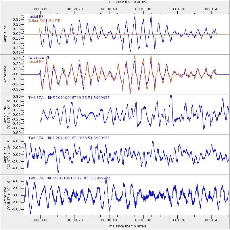
U37A Salina, OK, USA - Earthquake Result Viewer
*The percent match for this event was below the threshold and hence no stack was calculated.
| Earthquake location: |
Near East Coast Of Honshu, Japan |
| Earthquake latitude/longitude: |
40.3/142.8 |
| Earthquake time(UTC): |
2011/09/16 (259) 19:26:40 GMT |
| Earthquake Depth: |
35 km |
| Earthquake Magnitude: |
6.0 MB, 6.5 MS, 6.7 MW, 6.7 MW |
| Earthquake Catalog/Contributor: |
WHDF/NEIC |
|
| Network: |
TA USArray Transportable Network (new EarthScope stations) |
| Station: |
U37A Salina, OK, USA |
| Lat/Lon: |
36.41 N/95.12 W |
| Elevation: |
248 m |
|
| Distance: |
87.0 deg |
| Az: |
43.181 deg |
| Baz: |
319.532 deg |
| Ray Param: |
$rayparam |
*The percent match for this event was below the threshold and hence was not used in the summary stack. |
|
| Radial Match: |
60.158924 % |
| Radial Bump: |
400 |
| Transverse Match: |
60.616222 % |
| Transverse Bump: |
400 |
| SOD ConfigId: |
414626 |
| Insert Time: |
2012-01-23 13:56:32.614 +0000 |
| GWidth: |
2.5 |
| Max Bumps: |
400 |
| Tol: |
0.001 |
|
Signal To Noise
| Channel | StoN | STA | LTA |
| TA:U37A: :BHZ:20110916T19:38:51.399993Z | 1.213482 | 1.4717764E-6 | 1.2128539E-6 |
| TA:U37A: :BHN:20110916T19:38:51.399993Z | 1.0173489 | 1.8703246E-6 | 1.8384299E-6 |
| TA:U37A: :BHE:20110916T19:38:51.399993Z | 0.32920307 | 8.6484555E-8 | 2.6270882E-7 |
| Arrivals |
| Ps | |
| PpPs | |
| PsPs/PpSs | |


