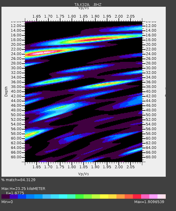
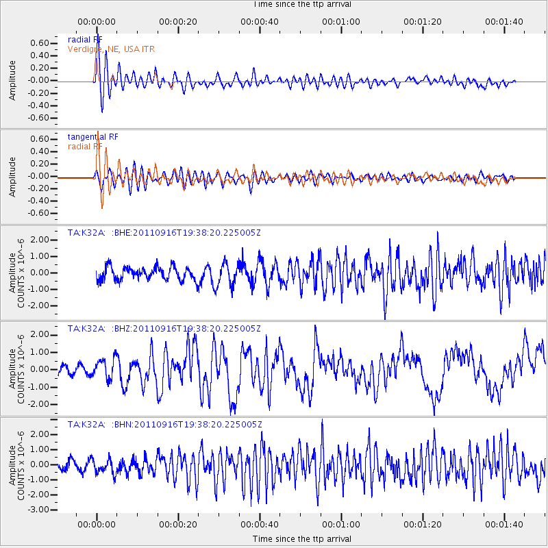
K32A Verdigre, NE, USA - Earthquake Result Viewer

Earthquake location: Near East Coast Of Honshu, Japan
Earthquake latitude/longitude: 40.3/142.8
Earthquake time(UTC): 2011/09/16 (259) 19:26:40 GMT
Earthquake Depth: 35 km
Earthquake Magnitude: 6.0 MB, 6.5 MS, 6.7 MW, 6.7 MW
Earthquake Catalog/Contributor: WHDF/NEIC
Network: TA USArray Transportable Network (new EarthScope stations)
Station: K32A Verdigre, NE, USA
Lat/Lon: 42.66 N/97.97 W
Elevation: 512 m
Distance: 80.9 deg
Az: 40.685 deg
Baz: 317.454 deg
Ray Param: 0.047947247
Estimated Moho Depth: 23.25 km
Estimated Crust Vp/Vs: 1.68
Assumed Crust Vp: 6.498 km/s
Estimated Crust Vs: 3.873 km/s
Estimated Crust Poisson's Ratio: 0.22
Radial Match: 84.3129 %
Radial Bump: 400
Transverse Match: 75.641624 %
Transverse Bump: 400
SOD ConfigId: 414626
Insert Time: 2012-01-23 13:57:14.300 +0000
GWidth: 2.5
Max Bumps: 400
Tol: 0.001

Signal To Noise

ChannelStoNSTALTA
TA:K32A: :BHZ:20110916T19:38:20.225005Z2.07280355.834351E-72.8147153E-7
TA:K32A: :BHN:20110916T19:38:20.225005Z1.36759264.513424E-73.3002695E-7
TA:K32A: :BHE:20110916T19:38:20.225005Z1.80396256.87345E-73.810196E-7
Arrivals
Ps2.5 SECOND
PpPs9.3 SECOND
PsPs/PpSs12 SECOND