J31A Geddes, SD, USA - Earthquake Result Viewer
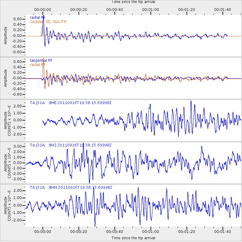
Earthquake location: Near East Coast Of Honshu, Japan
Earthquake latitude/longitude: 40.3/142.8
Earthquake time(UTC): 2011/09/16 (259) 19:26:40 GMT
Earthquake Depth: 35 km
Earthquake Magnitude: 6.0 MB, 6.5 MS, 6.7 MW, 6.7 MW
Earthquake Catalog/Contributor: WHDF/NEIC
Network: TA USArray Transportable Network (new EarthScope stations)
Station: J31A Geddes, SD, USA
Lat/Lon: 43.29 N/98.74 W
Elevation: 491 m
Distance: 80.0 deg
Az: 40.669 deg
Baz: 316.93 deg
Ray Param: 0.048522104
Estimated Moho Depth: 12.75 km
Estimated Crust Vp/Vs: 2.10
Assumed Crust Vp: 6.53 km/s
Estimated Crust Vs: 3.113 km/s
Estimated Crust Poisson's Ratio: 0.35
Radial Match: 82.24753 %
Radial Bump: 400
Transverse Match: 68.146675 %
Transverse Bump: 400
SOD ConfigId: 414626
Insert Time: 2012-01-23 13:57:59.762 +0000
GWidth: 2.5
Max Bumps: 400
Tol: 0.001

Signal To Noise

ChannelStoNSTALTA
TA:J31A: :BHZ:20110916T19:38:15.69998Z4.4220166.171094E-71.3955385E-7
TA:J31A: :BHN:20110916T19:38:15.69998Z0.783953852.7594683E-73.5199372E-7
TA:J31A: :BHE:20110916T19:38:15.69998Z1.47725514.5499664E-73.080014E-7
Arrivals
Ps2.2 SECOND
PpPs5.9 SECOND
PsPs/PpSs8.1 SECOND