J01D Myrtle Point, OR, USA - Earthquake Result Viewer
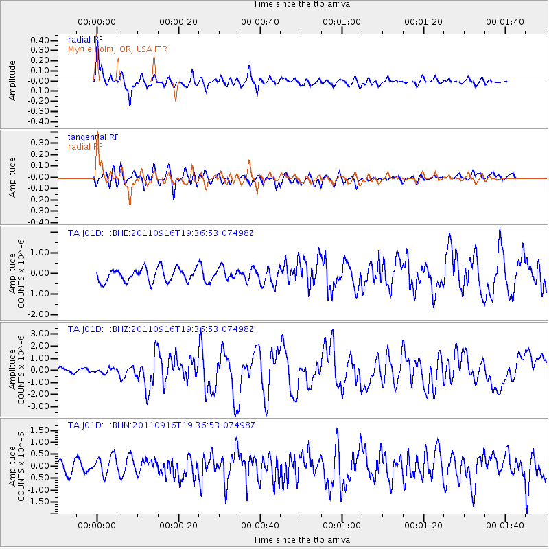
Earthquake location: Near East Coast Of Honshu, Japan
Earthquake latitude/longitude: 40.3/142.8
Earthquake time(UTC): 2011/09/16 (259) 19:26:40 GMT
Earthquake Depth: 35 km
Earthquake Magnitude: 6.0 MB, 6.5 MS, 6.7 MW, 6.7 MW
Earthquake Catalog/Contributor: WHDF/NEIC
Network: TA USArray Transportable Network (new EarthScope stations)
Station: J01D Myrtle Point, OR, USA
Lat/Lon: 43.16 N/123.93 W
Elevation: 131 m
Distance: 66.0 deg
Az: 53.097 deg
Baz: 303.262 deg
Ray Param: 0.057846382
Estimated Moho Depth: 15.25 km
Estimated Crust Vp/Vs: 1.81
Assumed Crust Vp: 6.522 km/s
Estimated Crust Vs: 3.598 km/s
Estimated Crust Poisson's Ratio: 0.28
Radial Match: 81.46932 %
Radial Bump: 400
Transverse Match: 66.800896 %
Transverse Bump: 400
SOD ConfigId: 414626
Insert Time: 2012-01-23 13:58:20.534 +0000
GWidth: 2.5
Max Bumps: 400
Tol: 0.001

Signal To Noise

ChannelStoNSTALTA
TA:J01D: :BHZ:20110916T19:36:53.07498Z0.717196351.9380496E-72.702258E-7
TA:J01D: :BHN:20110916T19:36:53.07498Z1.4967314.2661176E-72.8502902E-7
TA:J01D: :BHE:20110916T19:36:53.07498Z0.8642572.788978E-73.2270242E-7
Arrivals
Ps2.0 SECOND
PpPs6.3 SECOND
PsPs/PpSs8.3 SECOND