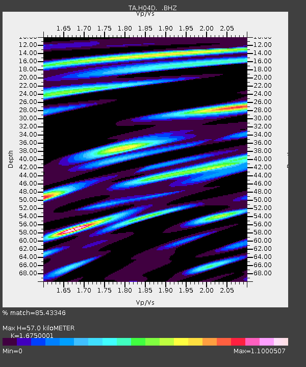
H04D Lebanon, OR, USA - Earthquake Result Viewer
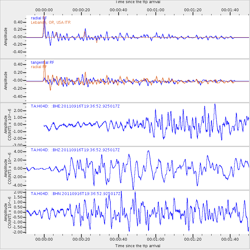
Earthquake location: Near East Coast Of Honshu, Japan
Earthquake latitude/longitude: 40.3/142.8
Earthquake time(UTC): 2011/09/16 (259) 19:26:40 GMT
Earthquake Depth: 35 km
Earthquake Magnitude: 6.0 MB, 6.5 MS, 6.7 MW, 6.7 MW
Earthquake Catalog/Contributor: WHDF/NEIC
Network: TA USArray Transportable Network (new EarthScope stations)
Station: H04D Lebanon, OR, USA
Lat/Lon: 44.52 N/122.74 W
Elevation: 284 m
Distance: 66.0 deg
Az: 51.332 deg
Baz: 303.368 deg
Ray Param: 0.057863392
Estimated Moho Depth: 57.0 km
Estimated Crust Vp/Vs: 1.68
Assumed Crust Vp: 6.566 km/s
Estimated Crust Vs: 3.92 km/s
Estimated Crust Poisson's Ratio: 0.22
Radial Match: 85.43346 %
Radial Bump: 400
Transverse Match: 67.652794 %
Transverse Bump: 400
SOD ConfigId: 414626
Insert Time: 2012-01-23 13:58:34.508 +0000
GWidth: 2.5
Max Bumps: 400
Tol: 0.001

Signal To Noise

ChannelStoNSTALTA
TA:H04D: :BHZ:20110916T19:36:52.925017Z1.16198652.4075095E-72.071891E-7
TA:H04D: :BHN:20110916T19:36:52.925017Z1.27573073.4897428E-72.7354855E-7
TA:H04D: :BHE:20110916T19:36:52.925017Z1.559344.1325757E-72.6502082E-7
Arrivals
Ps6.1 SECOND
PpPs22 SECOND
PsPs/PpSs28 SECOND