G34A Benson, MN, USA - Earthquake Result Viewer
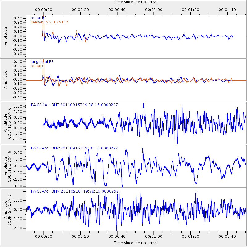
Earthquake location: Near East Coast Of Honshu, Japan
Earthquake latitude/longitude: 40.3/142.8
Earthquake time(UTC): 2011/09/16 (259) 19:26:40 GMT
Earthquake Depth: 35 km
Earthquake Magnitude: 6.0 MB, 6.5 MS, 6.7 MW, 6.7 MW
Earthquake Catalog/Contributor: WHDF/NEIC
Network: TA USArray Transportable Network (new EarthScope stations)
Station: G34A Benson, MN, USA
Lat/Lon: 45.24 N/95.64 W
Elevation: 316 m
Distance: 80.1 deg
Az: 37.664 deg
Baz: 318.567 deg
Ray Param: 0.048484325
Estimated Moho Depth: 15.5 km
Estimated Crust Vp/Vs: 1.84
Assumed Crust Vp: 6.571 km/s
Estimated Crust Vs: 3.571 km/s
Estimated Crust Poisson's Ratio: 0.29
Radial Match: 83.24063 %
Radial Bump: 400
Transverse Match: 70.52892 %
Transverse Bump: 400
SOD ConfigId: 414626
Insert Time: 2012-01-23 14:00:06.654 +0000
GWidth: 2.5
Max Bumps: 400
Tol: 0.001

Signal To Noise

ChannelStoNSTALTA
TA:G34A: :BHZ:20110916T19:38:16.000029Z2.12976435.68762E-72.6705396E-7
TA:G34A: :BHN:20110916T19:38:16.000029Z0.811987462.5446187E-73.1338152E-7
TA:G34A: :BHE:20110916T19:38:16.000029Z1.08652762.5768284E-72.371618E-7
Arrivals
Ps2.0 SECOND
PpPs6.5 SECOND
PsPs/PpSs8.5 SECOND