You are here: Home > Network List > TA - USArray Transportable Network (new EarthScope stations) Stations List
> Station P41A Barry, Barry, IL, USA > Earthquake Result Viewer
P41A Barry, Barry, IL, USA - Earthquake Result Viewer
*The percent match for this event was below the threshold and hence no stack was calculated.
| Earthquake location: |
Near East Coast Of Honshu, Japan |
| Earthquake latitude/longitude: |
40.3/142.8 |
| Earthquake time(UTC): |
2011/09/16 (259) 19:26:40 GMT |
| Earthquake Depth: |
35 km |
| Earthquake Magnitude: |
6.0 MB, 6.5 MS, 6.7 MW, 6.7 MW |
| Earthquake Catalog/Contributor: |
WHDF/NEIC |
|
| Network: |
TA USArray Transportable Network (new EarthScope stations) |
| Station: |
P41A Barry, Barry, IL, USA |
| Lat/Lon: |
39.67 N/91.06 W |
| Elevation: |
215 m |
|
| Distance: |
86.5 deg |
| Az: |
38.63 deg |
| Baz: |
321.763 deg |
| Ray Param: |
$rayparam |
*The percent match for this event was below the threshold and hence was not used in the summary stack. |
|
| Radial Match: |
74.554214 % |
| Radial Bump: |
356 |
| Transverse Match: |
57.800385 % |
| Transverse Bump: |
400 |
| SOD ConfigId: |
414626 |
| Insert Time: |
2012-01-23 14:04:21.701 +0000 |
| GWidth: |
2.5 |
| Max Bumps: |
400 |
| Tol: |
0.001 |
|
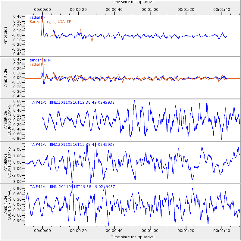
Signal To Noise
| Channel | StoN | STA | LTA |
| TA:P41A: :BHZ:20110916T19:38:49.024993Z | 2.4272516 | 5.551484E-7 | 2.2871481E-7 |
| TA:P41A: :BHN:20110916T19:38:49.024993Z | 0.94256186 | 3.3949024E-7 | 3.601782E-7 |
| TA:P41A: :BHE:20110916T19:38:49.024993Z | 1.3369603 | 2.6170102E-7 | 1.9574331E-7 |
| Arrivals |
| Ps | |
| PpPs | |
| PsPs/PpSs | |


