
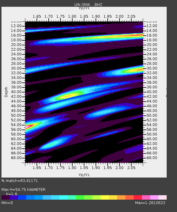
GNW Green Mountain (BB) - Earthquake Result Viewer
| ||||||||||||||||||
| ||||||||||||||||||
| ||||||||||||||||||
|
Signal To Noise
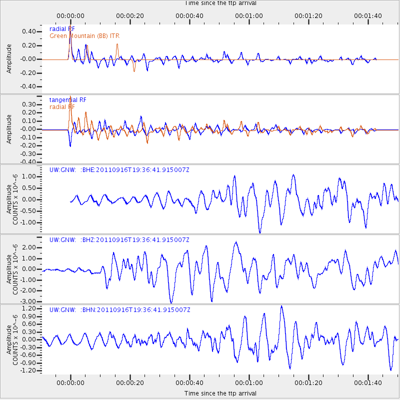
| Channel | StoN | STA | LTA |
| UW:GNW: :BHZ:20110916T19:36:41.915007Z | 1.3088208 | 1.1648931E-7 | 8.900325E-8 |
| UW:GNW: :BHN:20110916T19:36:41.915007Z | 1.1836329 | 1.5247079E-7 | 1.2881596E-7 |
| UW:GNW: :BHE:20110916T19:36:41.915007Z | 2.1084893 | 2.4055552E-7 | 1.1408904E-7 |
| Arrivals | |
| Ps | 5.3 SECOND |
| PpPs | 21 SECOND |
| PsPs/PpSs | 26 SECOND |

