
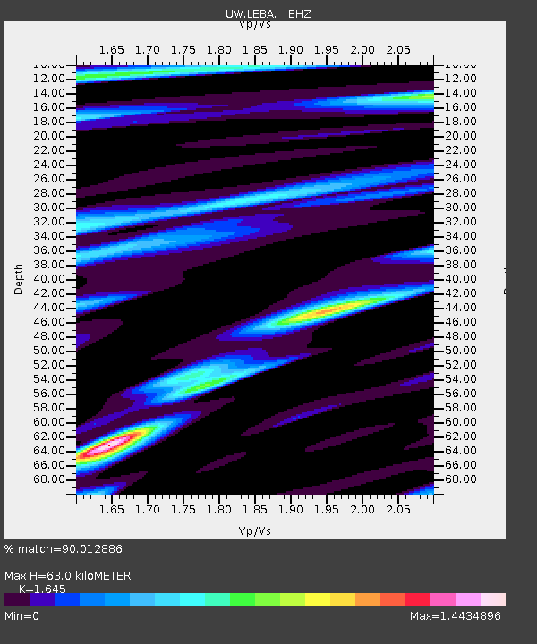
LEBA Lebam, WA, USA - Earthquake Result Viewer
| ||||||||||||||||||
| ||||||||||||||||||
| ||||||||||||||||||
|
Signal To Noise
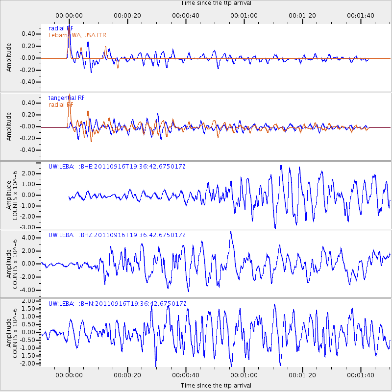
| Channel | StoN | STA | LTA |
| UW:LEBA: :BHZ:20110916T19:36:42.675017Z | 1.2785892 | 2.5817803E-7 | 2.0192414E-7 |
| UW:LEBA: :BHN:20110916T19:36:42.675017Z | 3.2187612 | 5.937382E-7 | 1.8446171E-7 |
| UW:LEBA: :BHE:20110916T19:36:42.675017Z | 1.2998763 | 2.871322E-7 | 2.2089193E-7 |
| Arrivals | |
| Ps | 6.5 SECOND |
| PpPs | 24 SECOND |
| PsPs/PpSs | 31 SECOND |

