You are here: Home > Network List > CI - Caltech Regional Seismic Network Stations List
> Station MPP McPhearson Peak > Earthquake Result Viewer
MPP McPhearson Peak - Earthquake Result Viewer
*The percent match for this event was below the threshold and hence no stack was calculated.
| Earthquake location: |
Off East Coast Of Honshu, Japan |
| Earthquake latitude/longitude: |
40.2/143.2 |
| Earthquake time(UTC): |
2011/09/16 (259) 20:11:16 GMT |
| Earthquake Depth: |
35 km |
| Earthquake Magnitude: |
5.5 MB, 5.8 MW |
| Earthquake Catalog/Contributor: |
WHDF/NEIC |
|
| Network: |
CI Caltech Regional Seismic Network |
| Station: |
MPP McPhearson Peak |
| Lat/Lon: |
34.89 N/119.81 W |
| Elevation: |
1739 m |
|
| Distance: |
73.1 deg |
| Az: |
58.51 deg |
| Baz: |
307.43 deg |
| Ray Param: |
$rayparam |
*The percent match for this event was below the threshold and hence was not used in the summary stack. |
|
| Radial Match: |
80.28915 % |
| Radial Bump: |
400 |
| Transverse Match: |
77.183846 % |
| Transverse Bump: |
400 |
| SOD ConfigId: |
414626 |
| Insert Time: |
2012-01-23 14:17:05.383 +0000 |
| GWidth: |
2.5 |
| Max Bumps: |
400 |
| Tol: |
0.001 |
|
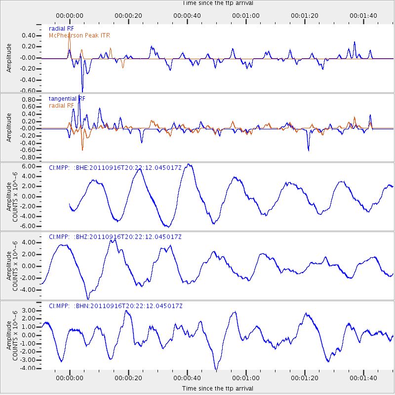
Signal To Noise
| Channel | StoN | STA | LTA |
| CI:MPP: :BHZ:20110916T20:22:12.045017Z | 1.2881008 | 2.3141513E-6 | 1.7965606E-6 |
| CI:MPP: :BHN:20110916T20:22:12.045017Z | 0.18864678 | 3.5974614E-7 | 1.9069828E-6 |
| CI:MPP: :BHE:20110916T20:22:12.045017Z | 1.615627 | 4.992549E-6 | 3.0901617E-6 |
| Arrivals |
| Ps | |
| PpPs | |
| PsPs/PpSs | |


